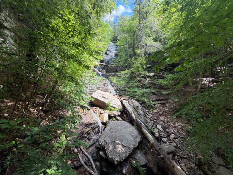
Standing tall in the northern part of Montenegro in Durmitor National Park, Bobotov Kuk is a goregoues hike and one of the most popular hiking trails in the Balkans. In this article, we’ll explore how to hiking Bobotuv Kuk in Durmitor National Park. There are several different routes to hike this trail and all offer a challenging hike mostly above tree level. We’ll go into the different options in the section below.
I’ve spent decades exploring family adventures, epic hikes, and National Parks across the world. For more inspiration, check out my National Parks Page or see some of my favorite destinations to plan your next adventure and make sure to join my weekly newsletter.
If you are planning a visit to Montenegro, start with our Guide to Montenegro.
Quick Look at the Hike to Bobotov Kuk
There are several routes you can choose to hike to Bobotuv Kuk. Here is a quick look at the 3 options, or you can scroll down for a longer description of each hike.
From Seldo mountain pass

Distance: 6 miles
Elevation Gain: 3,000 feet
Difficulty: Challenging (this is the easiest route)
This is the easiest route and is done as an out and back. Since you are above tree level the entire time, you have excellent views. This is a great route if you have your own car.
From Zabljak

Hike Length: 13.7 miles (depending on where in Zabljak you start from)
Elevation Change: 4900 ft.
Hike Time: 10 to 12 hrs
Difficulty: Challenging - this is the hardest of the 3 routes
This is the hardest option as it involves hiking up almost 5,000 fee of elevation. The trail from Zabljak starts in the forest and eventually becomes more exposed and rocky.
Hike from Sedlo Mountain Pass to Zapljak

Hike Length: 9.9 miles
Elevation Change: 3400 ft. Ascent, 4900 ft. descent
Hike Time: 8 to 10 hrs
Difficulty: Challenging
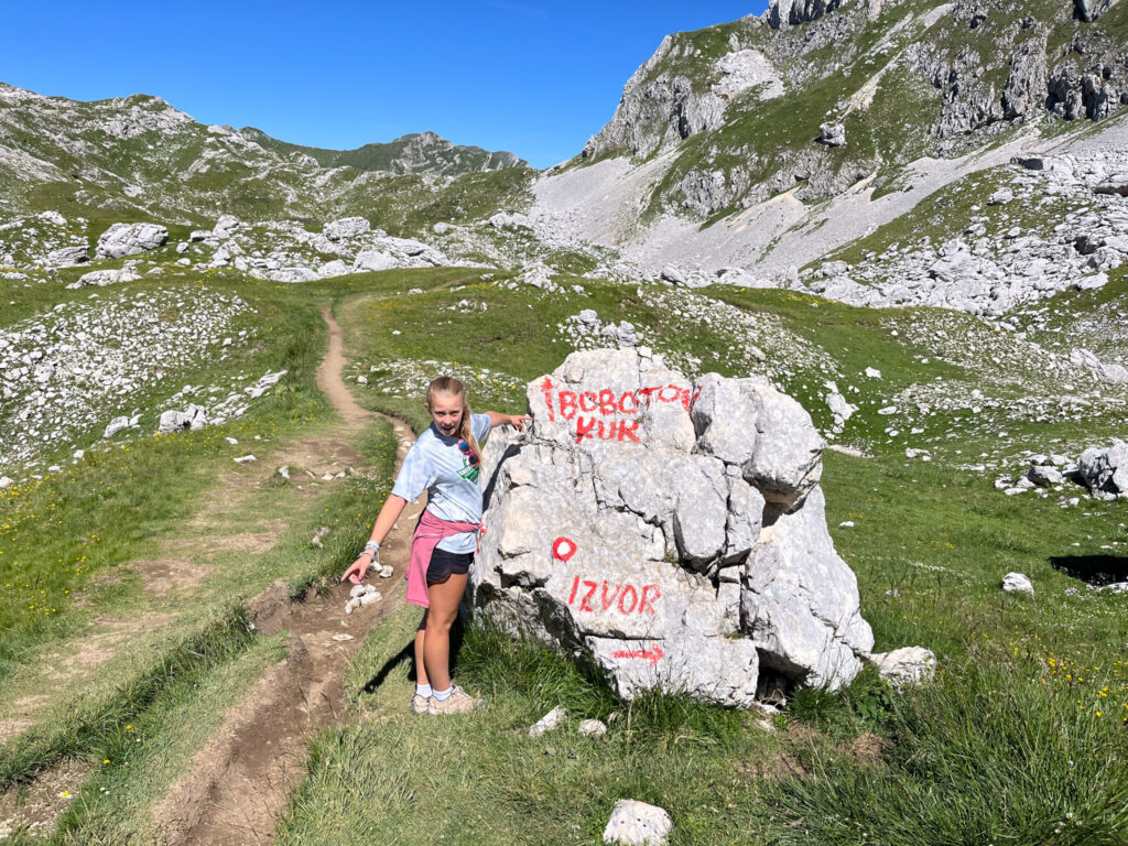
This is a great option as it is a point to point trail and is what we ultimately did. You will need to take a taxi to the start of the hike and then return on foot to town. Note that the hike from Bobotuk Kuk back to Zabljak has challenging as you navigate in a boulder field so give yourself more time than normal on the downhill section.
Things to Know about Hiking Bobotov Kuk
Is there a fee to hike Bobotov Kuk?
There is a fee to enter Durmitor National Park. The easiest place to pay this is at Black Lake in Zabljak. The fee is just a few dollars/person.
Is Bobotov Kuk Challenging?
Yes – no matter whick route you take, this is a challenging hike! The easiest route is to start from Sedlo Mountain Pass. We did this hike with our 12 year old and she was fine but there is some exposure and steep sections if you are hiking with kids.
What should you Wear?
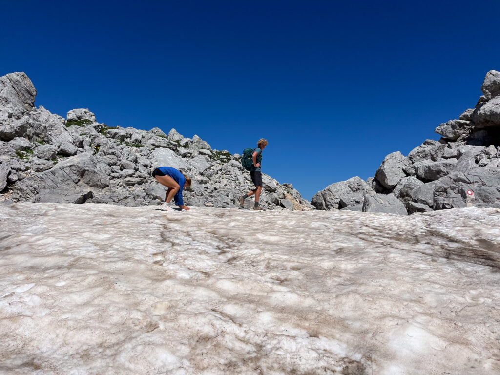
Most of this hike has some exposure and even in July there was snow. Be prepared for changing weather and bring plenty of layers. It also takes many hours to hike each of the route so be prepared with plenty of water and food.
What is the Elevation of Bobotov Kuk?
The elevation of Bobotuv Kuk is 2,523 meters (8,278 ft.).
Getting to the Trailhead
There are two trailheads to hike to Bobotov Kuk. You can either start your hike at Sedlo Pass or in the town of Zablajak.
From Žabljak, head southwest on P14, the main road that leads toward Durmitor National Park. This route is well-marked and leads you into the heart of the park. To get to Sedlo Pass it takes just under 30 minutes. The road leading to Sedlo Pass is narrow and winding, with sharp turns and steep inclines. The parking lot is not very large and so getting there early is helpful.
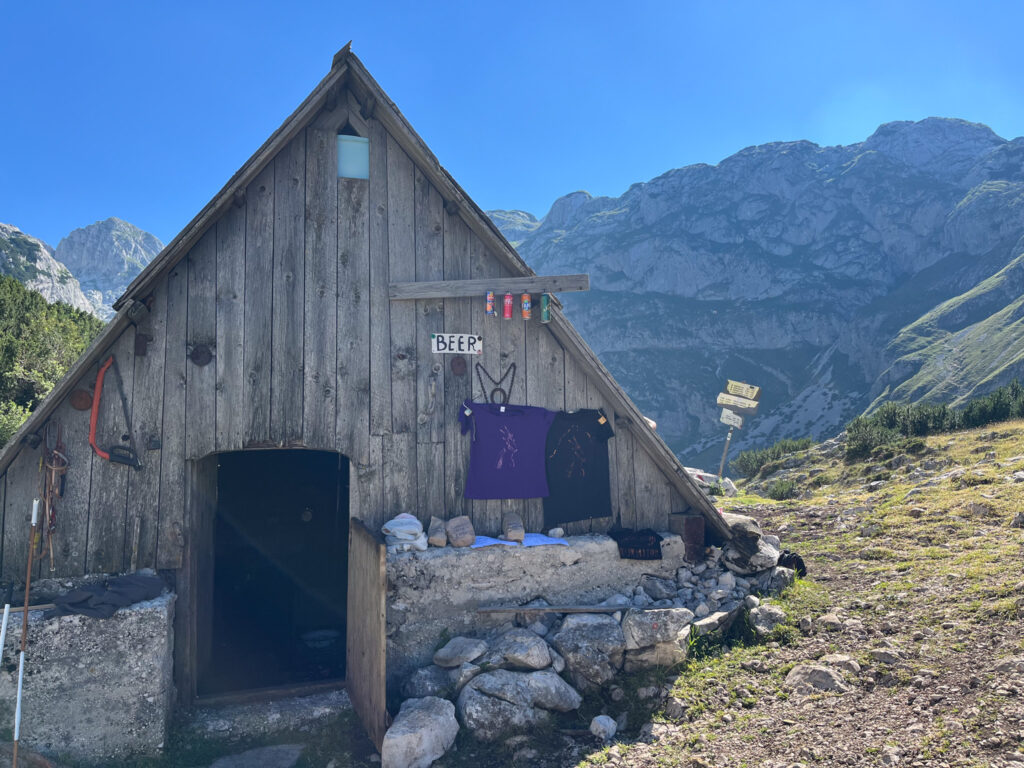
The other trailhead is to hike from the town of Zabljak. You can join the trail in several places, but the easiest place to start is at Black Lake. From the entrance gate, head uphill on the paved roads until you find the trailhead.
Map of Hiking Bobotov Kuk
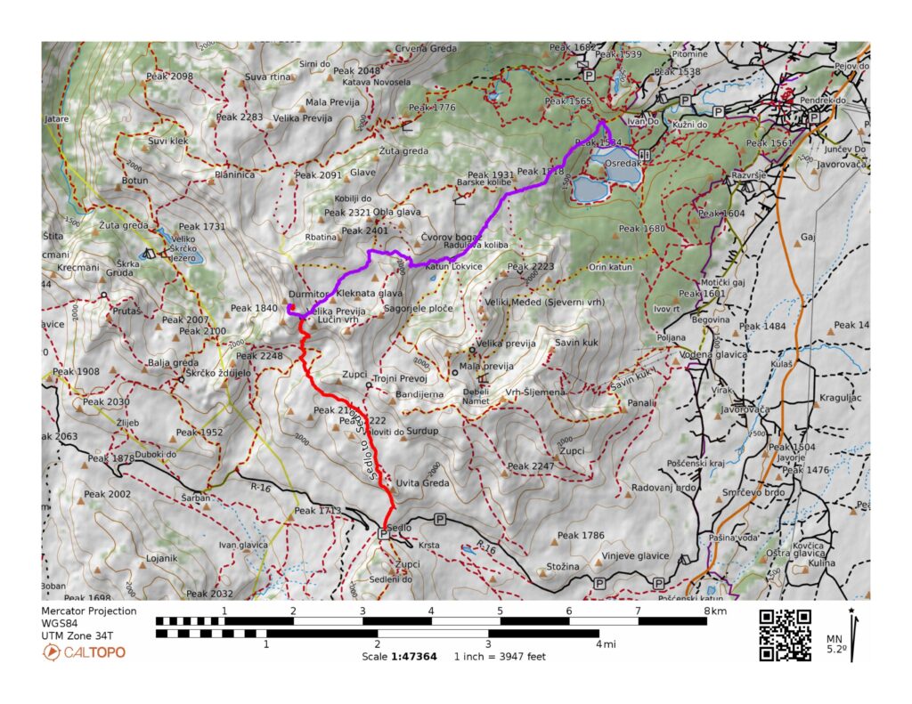
Details of the 3 Routes to Hike Bobotov Kuk
So which trail is the best? In our opinion, the best option is to start at Sedlo Pass and hike back to Zabljak. This is hard but gives you the best of both routes. Below you can see the details of each route.
Sedlo Pass as an Out and Back to Bobotov Kuk
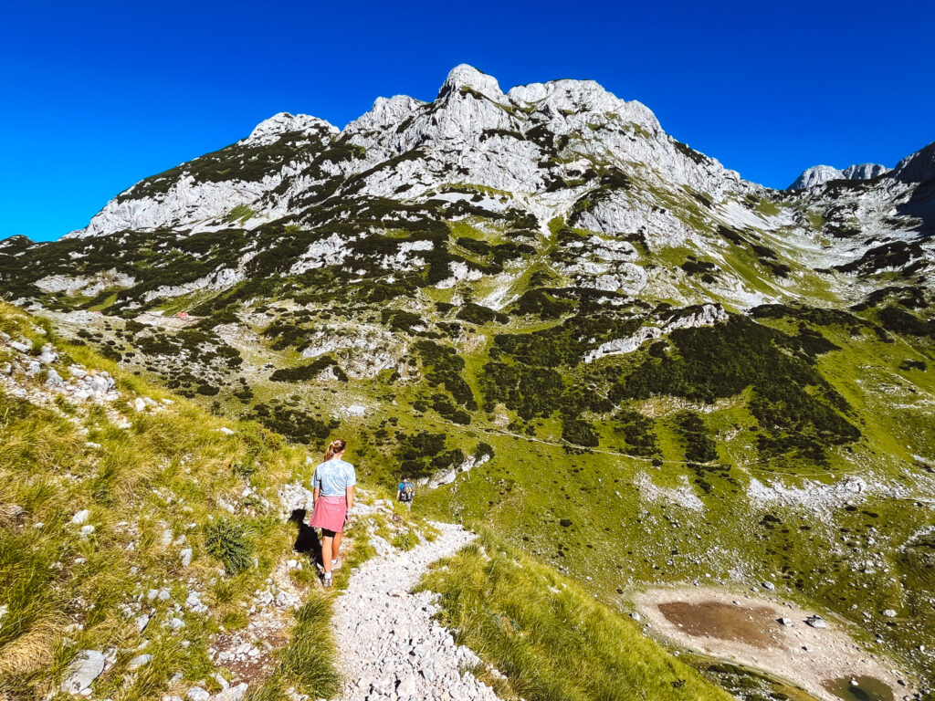
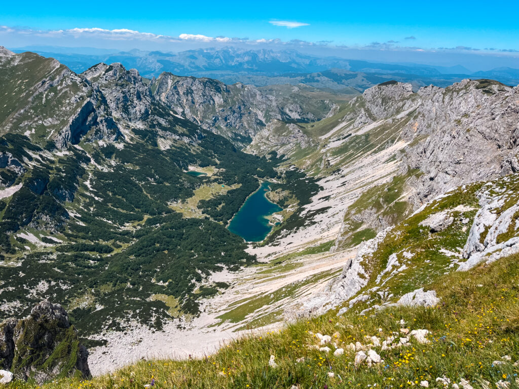
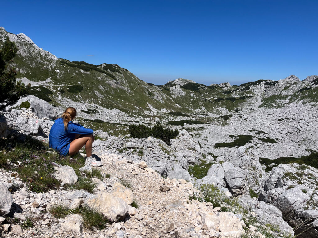
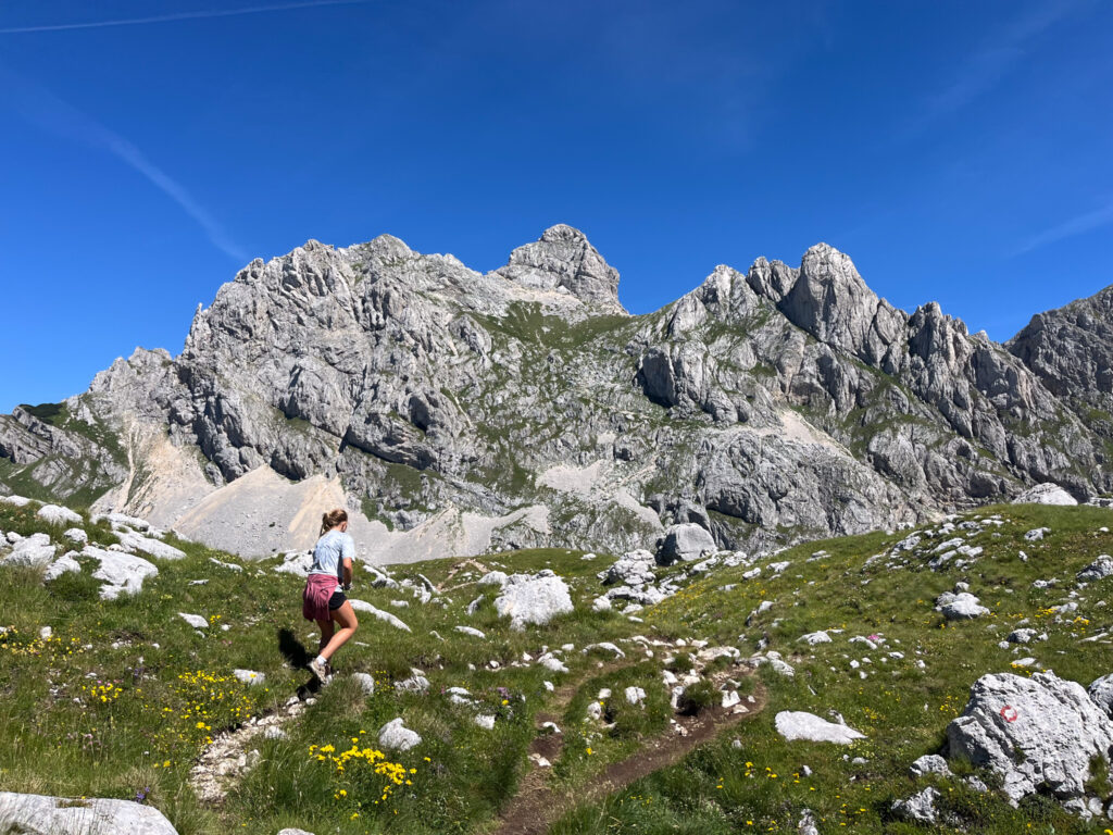
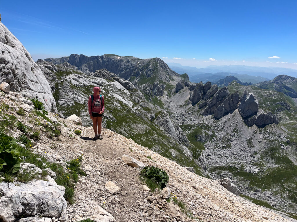
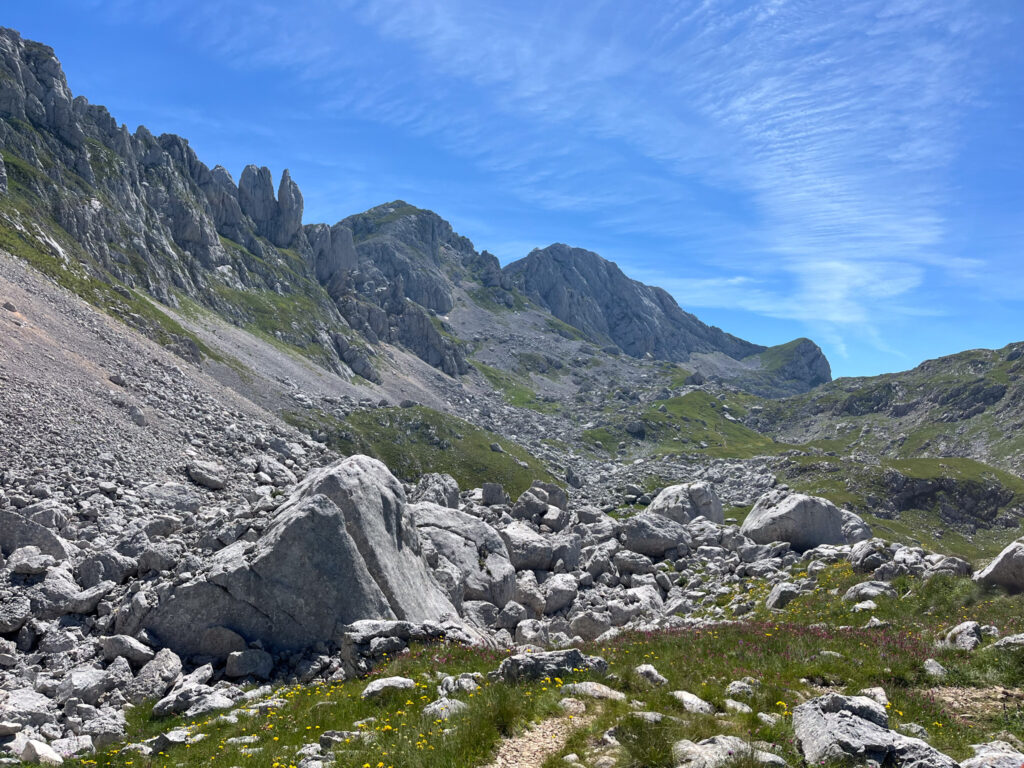
The hike starts by ascending the obvious trail from Sedlo Pass and you will encounter a few steep and exposed sections with some cables. After a steep climb, you emerge into a new valley with incredible views. For the next stretch, the trail is moderate winding between grass and rocks.
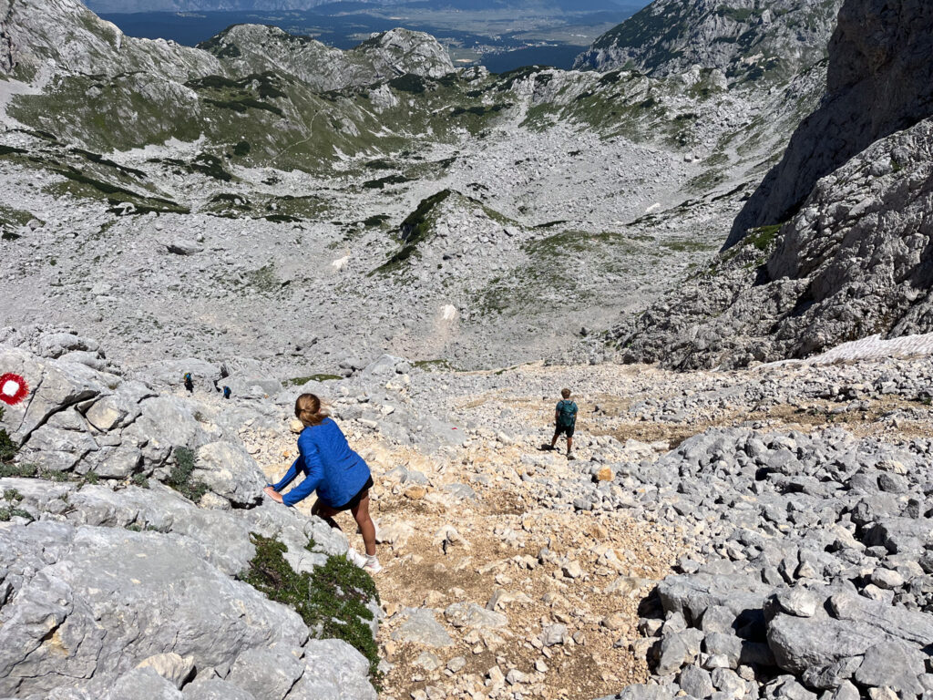
The final stretch up the saddle below Bobotov Kuk is extremely challenging and steep.
Once you reach the saddle, you have the final ascent. This is not as hard as the climb to the saddle, but it is very exposed with many cables. You should use caution here as the trail passes above itself. A climber dislodged a large rock that fell 20 feet and hit my daughter during the climb. Since this is a popular climb, use caution here.
After summiting, you will retrace your steps the way you came.
Sedlo Pass to Bobotov Kuk and to Zabljak as a Point to Point
The easiest way to manage the logistics of this hike is to take a taxi from Zabljak to Sedlo Pass. From here you will simply walk back to town.
The first part of this hike is described in the section above. It’s important to note that the trail up to the summit is a side trail and is not required for the through hike.
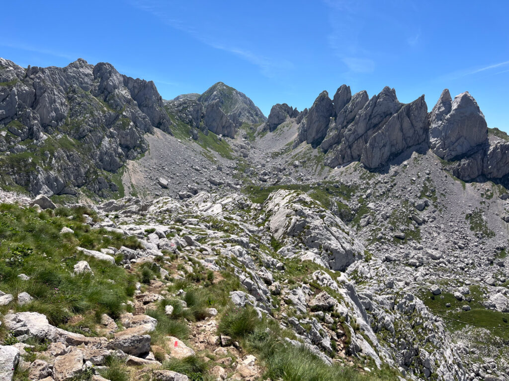
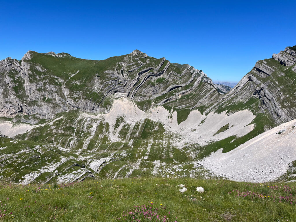
From the saddle, you will descend the rock slide area. This area is somewhat marked and is very challenging as every step is uneven. Give yourself plenty of time for this section. Once you reach the bottom of this slide, you will make your way across a rocky area until finally reaching some grassy sections. There are a few additional scree areas before you make it to the forest and have amore gentle walk back to town.
This is the route we did and besides the steep rocky sections and a few snowy sections, we highly enjoyed this route.
Bobotov Kuk at an Out and Back from Zabljak
This is the hardest route. Start the hike at Black Lake and ascend through the forest. The trail up to Bobotov Kuk is generally gradual and steady with some challenging scree sections. The final push up to the saddle is hard with plenty of loose rocks. This is a long hike. We saw people starting on this hike late in the day and I can’t imagine navigating some of these slopes in the dark!
It is possible to add the Ice Cave onto the route as well but that would add more elevation and length to the trail.