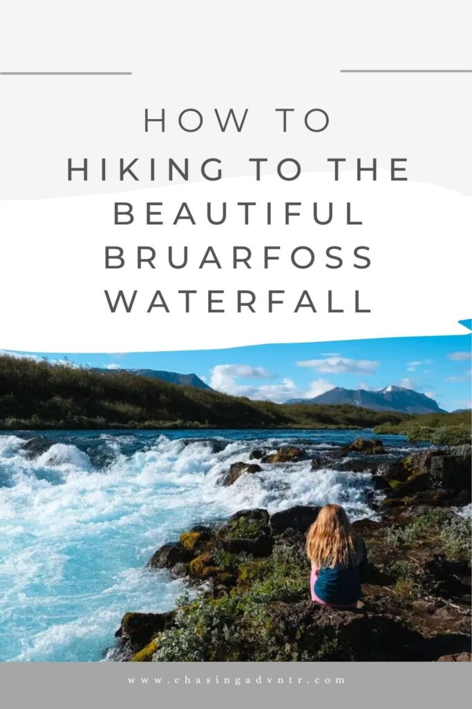
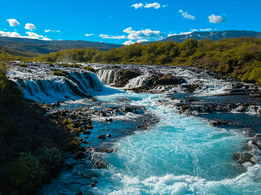
Described as the bluest river in Iceland, the hike to the Buarfoss Waterfall passes 2 smaller falls and finishes at the lovely Bruarfoss. An easy hike right on the Golden Circle, this hike is the perfect place to stretch your legs between some of the more crowded sites and enjoy a walk along the river.
While Bruarfoss is not the biggest or flashiest waterfall, it is extremely pretty and forms a beautiful site just where the river widens. It’s also a much quieter walk (although not a complete ‘hidden gem’) and overall a more peaceful experience than visiting some of the more popular and developed waterfalls in Iceland.
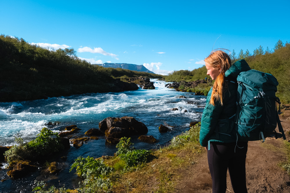
The 5 of us hiked to Bruarfoss during our visit to Iceland in June of 2022. We visited Bruarfoss on our first day in the country while we drove the Golden Circle and loved stretching our legs on a proper hike.
See more about exploring the Golden Circle and our 7 day Iceland Itinerary: Driving the Amazing Ring Road.
See all our guides to Iceland.
I’ve spent decades exploring family adventures, epic hikes, and National Parks across the world. For more inspiration, check out my National Parks Page or see some of my favorite destinations to plan your next adventure and make sure to join my weekly newsletter.
IMPORTANT INFORMATION ABOUT HIKING TO BRUARFOSS
If you did the Bruarfoss waterfall hike in past years, you likely did the shorter version across private property – this is now closed and the only way to get to the waterfall is along the longer hiking trail.
Also note that the All Trails version of this hike lists the elevation as almost 1,500 feet. We almost didn’t do the hike based on this and getting a late start. This is not accurate as there is very little elevation gain.
Read more below for an overview of the Bruarfoss Waterfall, Iceland, complete details on the Bruarfoss waterfall official parking, when to visit, and more.
Quick Look at the Burarfoss Hike
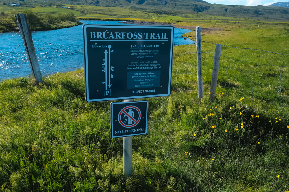
Distance: 4.4 miles (2.5 hours)
Elevation Gain: Very Little
Difficulty: Easy to Moderate
This is a lovely walk and we think it’s totally worth hiking to see not just the main Bruarfoss Waterfall, but both of the smaller waterfalls along the way. We did this hike during our drive around the Golden Circle and highly recommend it.
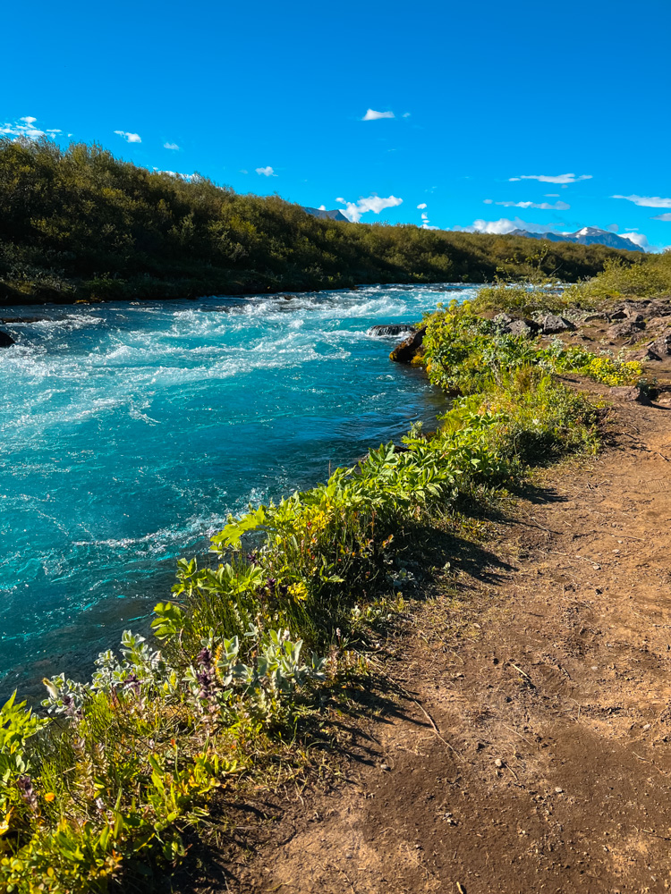
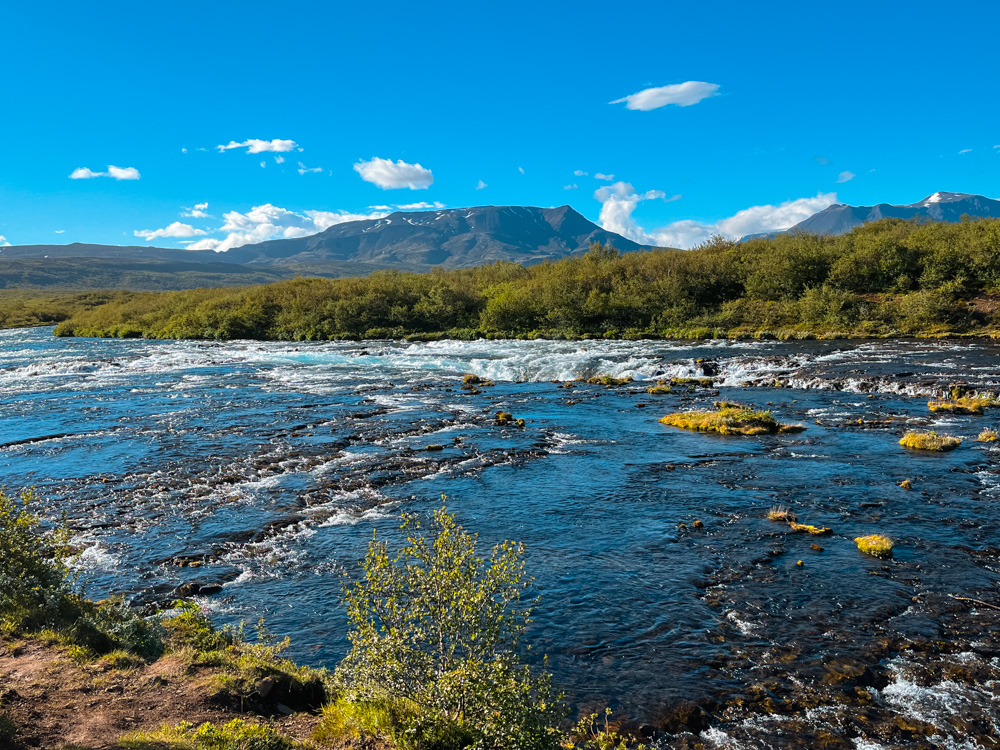
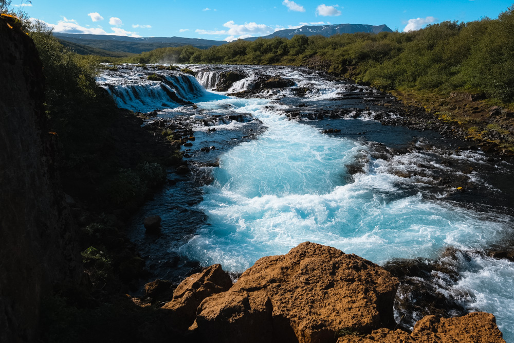
The trail mostly follows the Bruara River as it descends from the Langjokull Glacier. It is the glacial melt that gives the river its intense blue color. The trail passes two smaller waterfalls, the Hlauptungufoss and Midfoss. These are both pretty, but small waterfalls. The river continues on the last section up to Bruarfoss itself.
You can read a full description of the hiking trail below.
Things to Know About Hiking the Trail to Bruarfoss
What is the Best Time of Year to Hike to Bruarfoss?
The best time to hike the Bruarfoss is between June and Sept when the weather is the best – this is also the most crowded time of year. The trail can get muddy after a rain so be prepared with waterproof hiking boots. Since this hike is on the Golden Circle, it is open during the colder months as well, but be prepared for snow and ice and plan to hike with a good pair of microspikes.
What does Bruarfoss Mean?
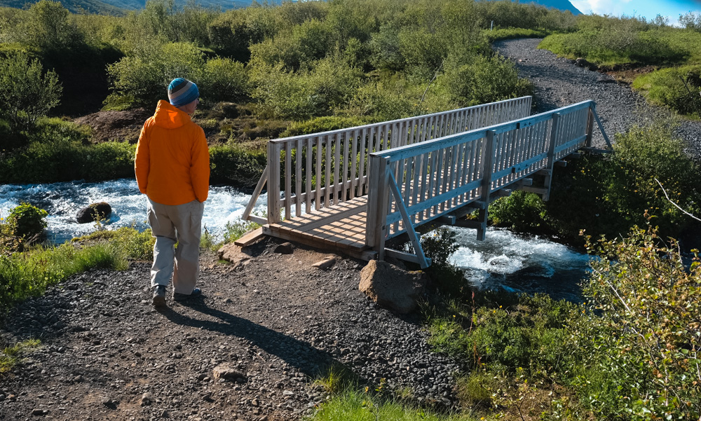
The word Bruarfoss comes from the word for bridge and references a stone arch ‘bridge’ across the river that collapsed many years ago. Today there is a small footbridge that crosses the river just below the falls.
Is Bruarfoss Waterfall Closed?
Since the old trail to the falls is no longer open, you might read online that the trail to Bruarfoss is closed. You can still hike to Bruarfoss, but you should know that the new trail is about 4 miles and is a true hike, unlike the short walk on the other trail.
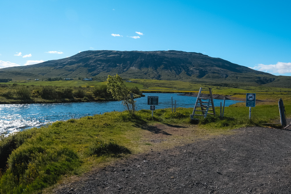
How to Find the Bruarfoss Hiking Trail Parking
There is a small parking lot right alongside the river with no facilities and about 20-30 parking spaces. Enter ‘Bruarfoss Waterfall official parking’ into google maps to find the parking lot. The parking lot is along route 37 right near the Bruarfoss River. While there is limited parking here, when we visited in late June in the afternoon there were still plenty of parking spaces.
Since there was an older trail to the falls that is now closed, make sure you find the correct parking lot for the trail.
To get to Bruarfoss from Reykavik, the driving time is about 1.5 hours.
Map of the Bruarfoss Hiking Trail
Use the map below to find the start of the hike or click on this link to Google Maps.
Complete Details of the Bruarfoss Hike
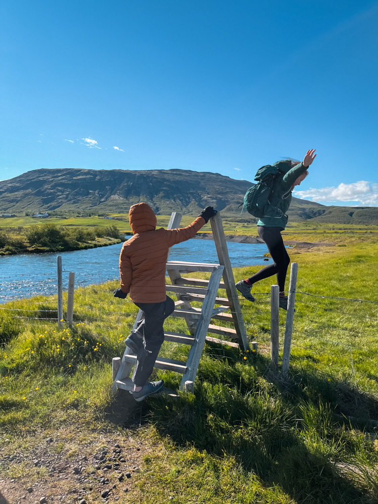
The hiking trail starts directly from the parking lot. You can start the hike on a the dirt road or climb the small stairs over the fence to get started. The first section of the hike is on this dirt road/trail and is the least scenic part of the hike (about 1 km). The trail passes mostly through fields and is not directly along the river for this stretch.
After this stretch, the trail crosses a small stream and becomes more muddy. We did this hike in late June after a little dry spell, so found it just a bit muddy, but you can tell that this trail could get very muddy after a heavy rain or in the spring after snowmelt. Very soon you come across the first exciting waterfall on this hike: Hlauptungufoss.
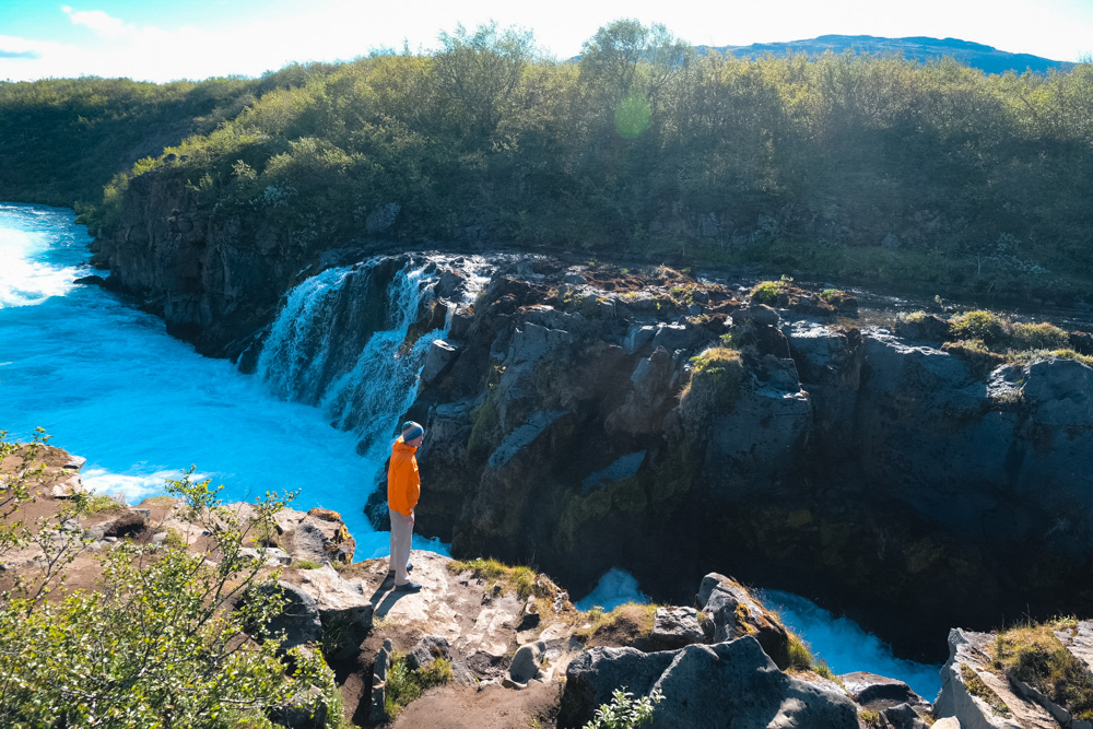
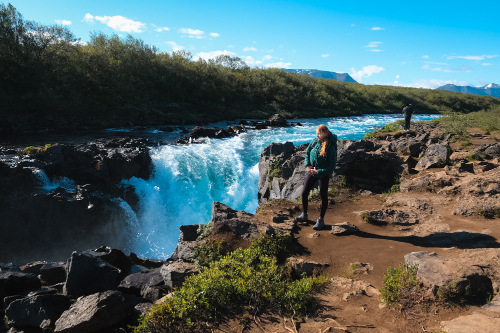
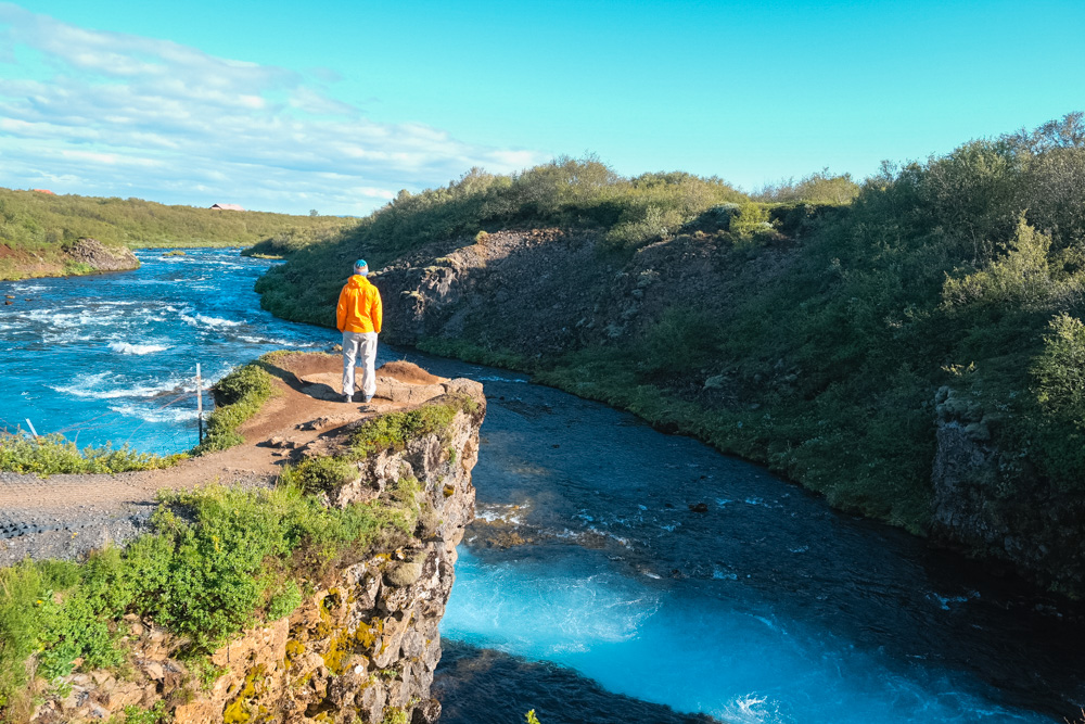
Hlauptungufoss Waterfall is a small waterfall by Iceland standards, but it a pretty little chute that the water shoots down at a narrow spot in the river. You can walk along the ricks right at the top of the waterfall. This is where we first noticed how truly blue and beautiful the water color is of this river.
From here, the trail follows much closer to the river, sometimes on rocky footing. The next named waterfall is Midfoss, but between these two falls, we loved the views of the river and water as it flowed over and around the rocks. Midfoss is more a series of smaller waterfalls in the river.
As you continue upstream from Midfoss, the river mellows a bit and you will need to pick your trail. There are several places where people have gone off trail to take photos so try to stick to the larger/main trail as you walk. You will see a few houses on the same side of the river and cross a small bridge but you stay between the river and the houses.
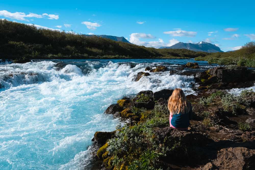
After one last little uphill, you will arrive at the Bruarfoss waterfall and the footbridge that crosses the river. The waterfall with the clear blue water spreads right across the river with many smaller cascades and is really quite lovely. When we arrived there were only 2 other people at the site and we took our time taking some photos and looking at the waterfall.
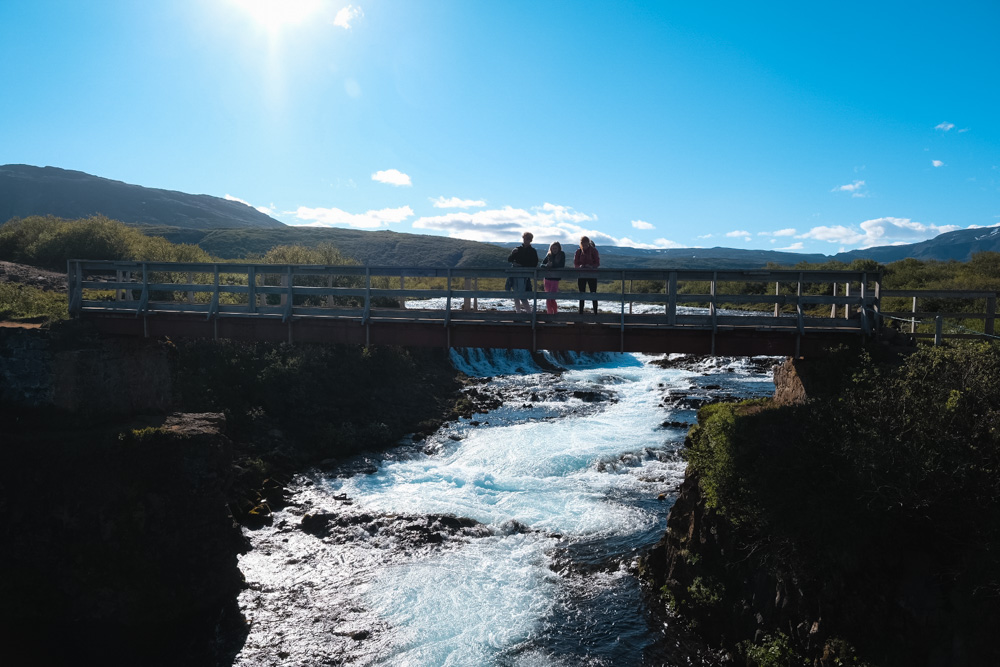
The view down from the bridge back down the river is also very pretty. After you’ve enjoyed the waterfall, turn around and continue down the way you came.
To make sure this trail remains open for others, please respect the area, and clean up your trash.
Looking for more information about the best sites on the Golden Circle, make sure to check out: