
Looking for a nice hike with fewer crowds and some summit views? Hightop Peak Trail in Shenandoah is a lovely and moderate 3 mile trail just south of route 33 in the park. While you won’t get full views from the summit, there are several good overlooks near the top.
The entire trail is on the Appalachian Trail and has a moderate incline.
Looking for more guides to Shenandoah? Check out:
- 10 Best Hikes in Shenandoah National Park
- Complete Guide to Visiting Shenandoah National Park
- Want more updates on the National Parks? Sign up for our newsletter.
Our National Parks are full of epic hikes, sweeping vistas, and amazing ecosystems.  If you like our parks, you'll love our National Parks Newsletter or you can explore exactly how we plan a National Parks Trip.

Visiting all 63 National Parks?  Join the Club.

Quick Look at Hightop Peak Trail
Distance: 3 miles
Elevation: 930 feet
Difficulty: Moderate

(you can also do this as a point to point trail that adds a little distance)
Start the hike at the Hightop Peak Trailhead and ascend gradually through the forest. The trail is slow and steady with generally good footing. The trail has several good overlooks near the summit but does not actually go right to the summit. Most of the views are to the west.

Hightop Peak Trail: Things to Know
Fee
The Hightop Peak Trail is located within Shenandoah National Park which means you will need to pay a fee to enter. Once you are in the park, you can park for free. You can see more about the entrance fee on the NPS official page.
Trailhead
The trailhead is located just south of Route 33 (mile 66.7) and has space for about 5-6 cars off the road. Cross Skyline Drive and take the white-blazed Appalachian Trail for the hike.
Dogs on the Trail
Dogs are allowed on the trails but should be leashed.
Kids on the Trail
This is a great hike for kids, although the views aren’t as stunning as some of the other trails in the park. I did this with my two teens who enjoyed it but it is easiest enough for even the youngest hikers.

Details of Hiking the Hightop Peak Trail
The trail starts across the street from the parking lot. The easiest way to do this hike is as an outand back however we did this as a point to point so I’ll describe how to do both.
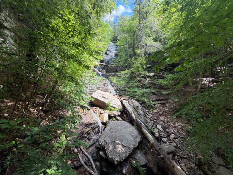
The trail is gradual uphill the entire way ascending around 900 feet in 1.5 miles. The path itself is in the woods the entire time and you will pass many fallen trees and rocks along the way. The trail has some rocks and roots but generally has good footing. We enjoyed the hike despite the windy and cool weather conditions in November.
Just before the highest point on the hike, the trail flattens a bit and there are several viewpoints on the west side with lookouts to the mountains and valleys. The trail doesn’t reach the full summit (although you are very close). At this point you can turn around and retrace your steps or continue South on the AT.
Visiting all 63 National Parks?  Join the Club.

The National Parks Club is for anyone visiting (or who has already visited) the National Parks across the US.  Get tips, resources and more to help you plan the most amazing adventures across the US.

Shop our National Park Designs
Looking for Shenandoah designs? We’ve got some ideas for you.