
Just north and east of Lincoln and Lafayette, Mt Garfield NH is a straightforward hike that offers tremendous views of the presidential range in the White Mountains of New Hampshire. Done as a straightforward out and back, the trail is generally gradual with several stream crossings and a steep climb right towards the summit.
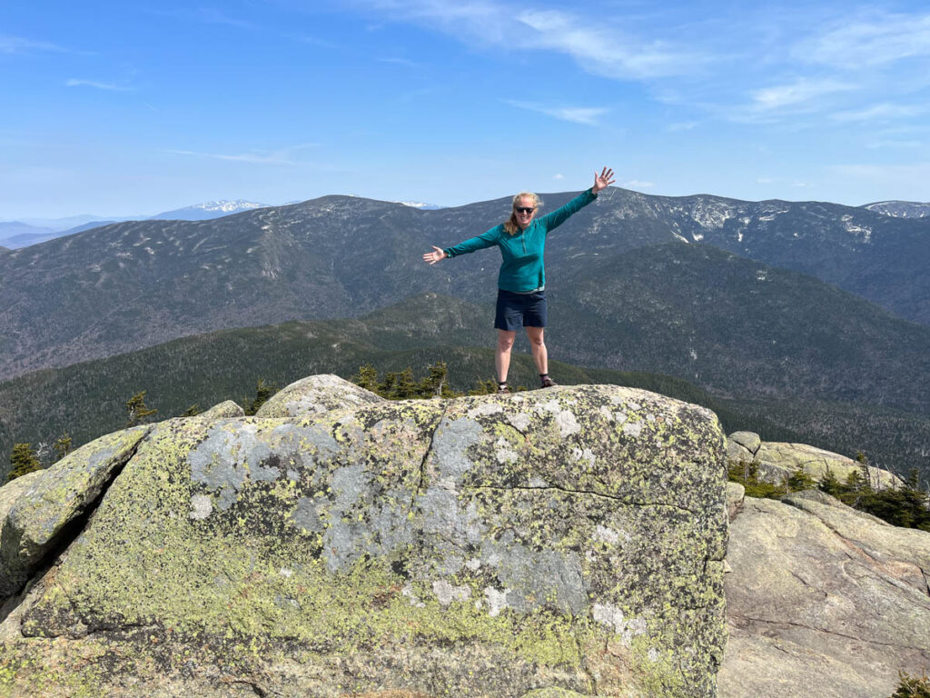
While most of the trail is through the woods, the summit is completely clear with views in 360 degrees. I most recently hiked Mount Garfield in late winter and you can see details of this hike below.
Explore more amazing hikes in the White Mountains and Around the World.
Looking to explore adventures around New England? I've spent almost my entire life living in New England and love to explore, photograph, and write about the region. You can find details of incredible hikes, hidden gems, delicious food and my top tips for traveling around the Northeast here and in my newsletter: Uncover New England.
Quick Overview of Mt Garfield NH
Distance: 9.6 Miles
Elevation Gain: 3,000 feet
Difficulty: Moderate/Difficult
The Mt Garfield trail starts from a trailhead a short distance down a dirt road off route 3 in New Hampshire. Just north of Franconia Notch, it’s only a few minutes off the main route of 93 the travel North-South through the White Mountains.
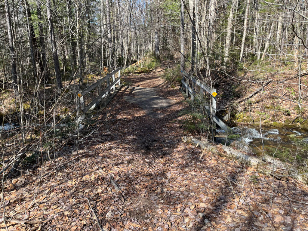
From the trailhead, the trail ascends very gently for the first 1/2 mile before it reaches several stream crossings. We visited on a very warm early spring day and the river was running very high. We ended up taking off our boots and crossing bare footed through the river. After crossing, we discovered that there is bridge further up the stream that makes for an easy crossing. To get to the bridge, follow the small trail just before the first stream crossing along the stream for a few hundred feet until you reach a wide bridge.

After the river crossings, continue uphill on the main trail. The trail slowly increased in elevation through the forest until just below the summit. The last 1/4 mile is steep with some scrambling to reach the exposed summit.
Scroll to the bottom to see more photos and a more detailed description of this Mt Garfield NH hike, or visit our New Hampshire page for more hikes in the White Mountains.
Things to Know about the Mt Garfield Hike
The Mount Garfield hike is one of the 48 – 4,000 footers with an elevation of 4,501 feet. Below you can see some general information about hiking Mt Garfield New Hampshire.
Best Time to Hike Mount Garfield
Mount Garfield makes a good hike year round although the best time to hike this trail is during the warm months between May and October. Since only the very last section of the trail is out of the forest, this is a good choice if the high summits are experiencing windy conditions. If you are hiking Mt Garfield in the winter, be prepared for the last steep section.
I hiked Mount Garfield in the late winter and the entire lower section of the trail was muddy and very wet. It’s a good idea to read the latest reviews on the All Trails description to see more about the recent trail conditions.
Parking for the Mount Garfield Trailhead
Parking for the Mount Garfield trail starts up a dirt road just over a mile from the turn off route 3. In the winter, there is a gate across the road which means you will need to hike the extra 1 mile to the trailhead each way. The parking lot has a decent amount of parking, and there is some additional parking on the dirt road.

Map of Mt Garfield NH

Details of Hiking Mount Garfield NH
We left the parking lot at the gate for an April hike of Mount Garfield on an exceptionally warm day. Since the gate was down, we started the hike with a 1.1 mile walk along the road. The road is perfectly flat with a pretty view of the river. After just over a mile you will reach the well marked trailhead and the parking lot. From here the trail ascends gently for the first half mile of the hiking trail until the first river crossing.
If the water is low, there are plenty of rocks that make the river crossing easy, although the trail crosses the river several times. If there has been a lot of rain or you are hiking in the spring, you can cross the river on the bridge that is just upriver from here. Take the small trail upstream from the first river crossing and follow the river for a few minutes until you see the bridge.

Cross the bridge and the turn left onto the main trail. This is the only point where there is a trail junction until just before the summit. Follow the trail through the forest as the trail gradually become steeper. About 1 mile from the summit, the trail does several switchbacks. About 1/4 mile from the summit, the trail ascends steeply up the final part of the trail to the summit. This is the first time you get any sort of view.

The very final part of the summit is a slab with no trees and 360 degree views. There is a small platform right at the top and you can see the ridgeline connecting Lincoln and Lafayette and the Presidential Range. Even though we did this hike in early April, temperatures were in the 70s with no wind, so we lingered at the summit before retracing our steps.
Common Questions about Hiking Mount Garfield New Hampshire
Is Mount Garfield Hard?
Mount Garfield is a challenging hiking trail mostly due to the length and last steep scramble to the summit. Mt Garfield is considered a moderate 4,000 foot hiking in New Hampshire.
Is Mt Garfield a 4,000 footer?
Mt Garfield is one of the 48 4,000 foot mountains in New Hampshire and is the 17th tallest mountain in the White Mountains.
Are dogs allowed on Mount Garfield?
Dogs are permitted on Mount Garfield
How long does it take to hike Mount Garfield?
The trail should take between 5-7 hours to hike Garfield. Give yourself additional time depending on the trail conditions.