The shortest and one of the easiest 4,000-footers in the White Mountains, Tecumseh Mountain is a wonderful hike with a gorgeous view from the summit. There are 2 trail options to hike to the summit of Mt. Tecumseh, the Tripoli Trail and the Mount Tecumseh Trail. Both trails are about 6 miles round trip and are moderate trails with mostly rocky and wooded terrain.
We hiked both these trails in October of 2022 and enjoyed the incredible views and fall colors, especially on the Mount Tecumseh Trail, leaving from the base of Tecumseh Mountain. Below you can find all the details on hiking these two trails.
See the 11 Best Hikes in New Hampshire’s White Mountains or 9 Best Fall Foliage Hikes in the White Mountains or see all our NH Guides.
Looking to explore adventures around New England? I've spent almost my entire life living in New England and love to explore, photograph, and write about the region. You can find details of incredible hikes, hidden gems, delicious food and my top tips for traveling around the Northeast here and in my newsletter: Uncover New England.
Quick Look at Hiking Tecumseh Mountain
Below you can see a quick look at the 2 hiking trails to the summit of Tecumseh. Scroll down for a more complete description of each hiking trail as well as some important things to know and how to get to the Tecumseh Trailhead parking.
Tripoli Trail
Distance: 6.2 miles
Elevation Gain: 2,400 feet
Difficulty: moderate with some challenging rocky sections
The Triploi Trail starts with a small stream crossing and begins to ascend steadily through the forest. A typical, rocky New Hampshire hiking trail, the Tripoli trail has several steep and rocky sections. A pair of hiking poles is helpful on the way down and many of the rocks are mossy and slippery. The trail eventually ascends to a wooded right and is relatively flat until the final steep push to the summit.

Mount Tecumseh Trail
Distance: 5.2 miles
Elevation Gain: 2,300 feet
Difficulty: Moderate
The Mount Tecumseh Trail leaves from the base of Waterville Valley and starts with a very gentle incline through the forest. We hiked this trail in the fall, and the lower section of the trail was beautiful with the fall colors. The trail begins to get steeper as it follows in the wood beside one of the ski trails. Make sure to take one of the very short trails over to the ski trail for sweeping views of the valley. From here the trail ascends steep and steady up many stone stairs to a small loop at the summit.
Things to Know About Hiking Mt. Tecumseh
Best Time of Year to Hiking Mount Tecumseh: While you can hike Tecumseh Mountain year round via the Mount Tecumseh Trail, the best time of year to hike the trail is May-October. The incredible views from the ski trail make this a great hike to enjoy the fall foliage. This is a good hike in the winter as well although the road to the Tripoli Trailhead may be closed in the winter.
What to Pack for Hiking the Tecumseh Trail: In general you can pack for any other White Mountain Hike. I wished I had brought hiking poles for several sections of both the Mt. Tecumseh Trail and the Tripoli Trail. You will definitely want a good pair of hiking boots for the rocky sections. As always, pack layers and other hiking essentials (you can see my list of what to bring on a day hike here).
Is Mount Tecumseh Hard? Mount Tecumseh is a moderate hike, and while it is a short distance for a 4,000 fotter in NH, it is consistently steep since you are gaining over 2,000 feet of elevation over 2.5-3 miles. The Mount Tecumseh Trail from Waterville Valley is the easier trail but also the most crowded.
How long does it take to climb Mount Tecumseh? It takes about 3-4 hours to hike to the summit of Mount Tecumseh in the White Mountains. Both the Tripoli Trail and the Mouth Tecumseh Trail are about 6 miles in length.
Getting to the Tecumseh Mountain Trailhead
There are 2 trailheads about a 10-minute drive apart down a dirt road. The Tecumseh Trailhead on Tripoli Road is not open in the winter. Below is a short description of how to get to the Tecumseh Trailheads and you can see the locations on the map below. We found the directions on google to be easy and accurate.
Tripoli Trailhead Parking: From 93, take exit 31 and follow Tripoli Rd. This road will pass through a gate and turn to dirt. There is a river on your right and we saw lots of car pulled over and people camping along the river. After 5.5 mile, the Tecumseh Triploli Trailhead parking lot is marked with a sign. The parking lot is relatively small with space for 5-6 cars.
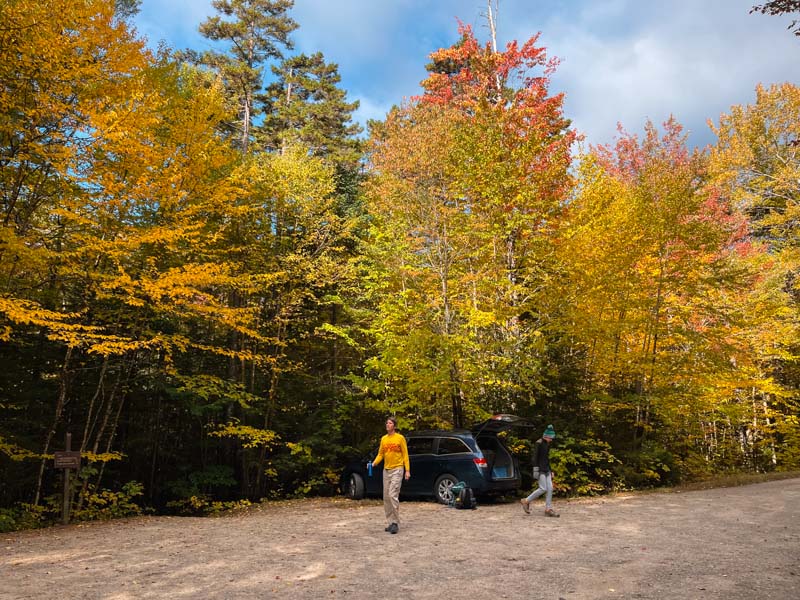
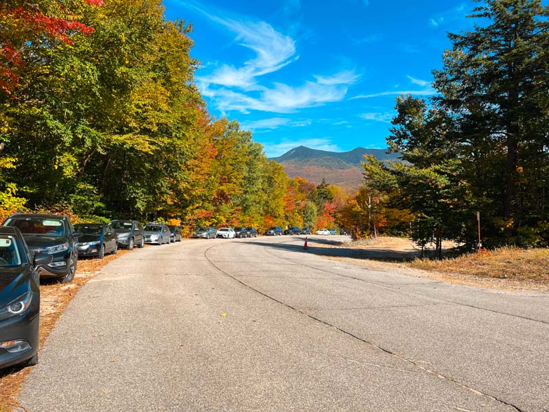
Mount Tecumseh Trail from Waterville Valley: This trailhead is by far the most popular and there is plenty of parking up and down the road by the trailhead. To get to the trailhead off 93, take exit 28 and follow route 49 east for about 10 miles. Turn onto Tripoli Rd to the Ski Mountain.
Mt. Tecumseh Trail Map

See: 11 Easy Hikes in the White Mountains
Details of the Mount Tecumseh Hike
Below you can find complete details for the Mt. Tecumseh hike up either the Tripoli or Tecumseh Trails. You can also do this hike as a point to point hike, but you will need to spot a car. This is how we did the hike and I would recommend going up the Tripoli Trail and down the trial to Waterville Valley. It’s always a good idea to check the trail conditions – you can read the most recent reviews of the hiking conditions on All Trails.
Tripoli Trail
The Tripoli Trail is well marked from the Trailhead on Tripoli Rd and there are no turnoff options on the trail until the Summit of Tecumseh. The trail itself was easy to follow and in good condition.
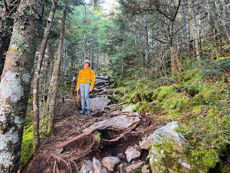
The trail starts in the parking lot and crosses a very small stream before starting to ascend on a wooded trail. The trail here begins to slowly increase in slope, getting steeper and steeper as it ascends to the Mount Tecumseh Northeast Peak.
After getting to the unremarkable first summit, the trail flattens out and you make your way across a wooded ridge. There is one view from the top of the steep climb through some trees out towards Lincoln and Lafayette. There are several areas with steep rocky sections and coming down these sections can get pretty slick.
After crossing the right, there is a last steep section to the summit, although this section is relatively short, it does have a few more steep, rocky and moss covered sections to navigate. This trail is much less traveled and we saw only one other person during this section of the hike.
Mount Tecumseh Trail via Waterville Valley Trailhead
This is the more popular trail to take to the summit of Tecumseh Mountain. It is slightly shorter with less elevation gain and also offers better options for view on the way up. Due to it’s nearness to the Waterville Valley ski slopes, you will see a lot more people hiking on this trail.
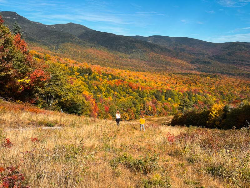
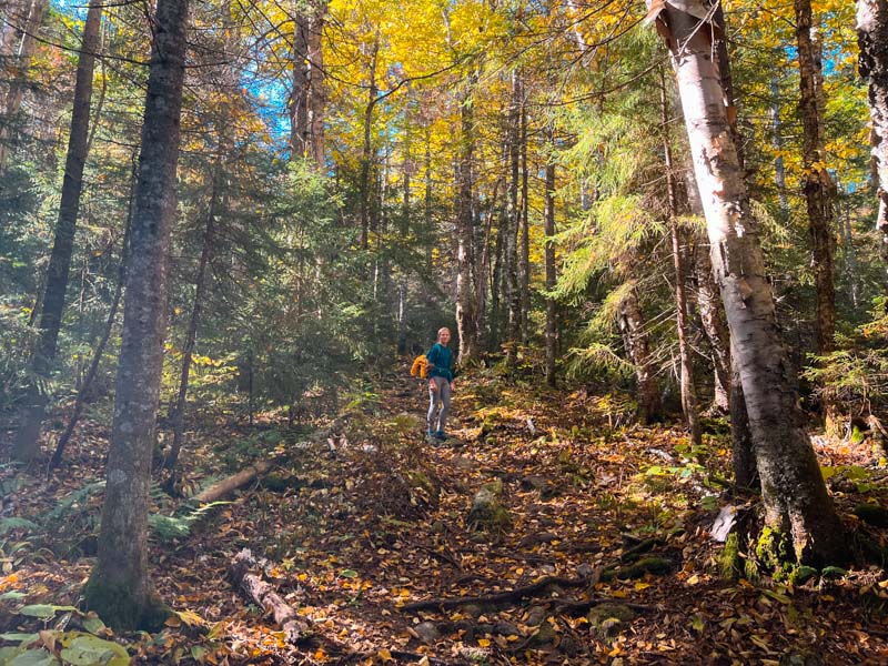
The trail starts by crossing a small stream and continues mostly flat with just a gentle include for the first 0.8 miles. It then crosses the stream again and begins to ascend more seriously. The trail goes through several switchbacks. This lower section of the trail is through a beautiful forest that really comes alive in late Sept and early Oct with the changing leaves.

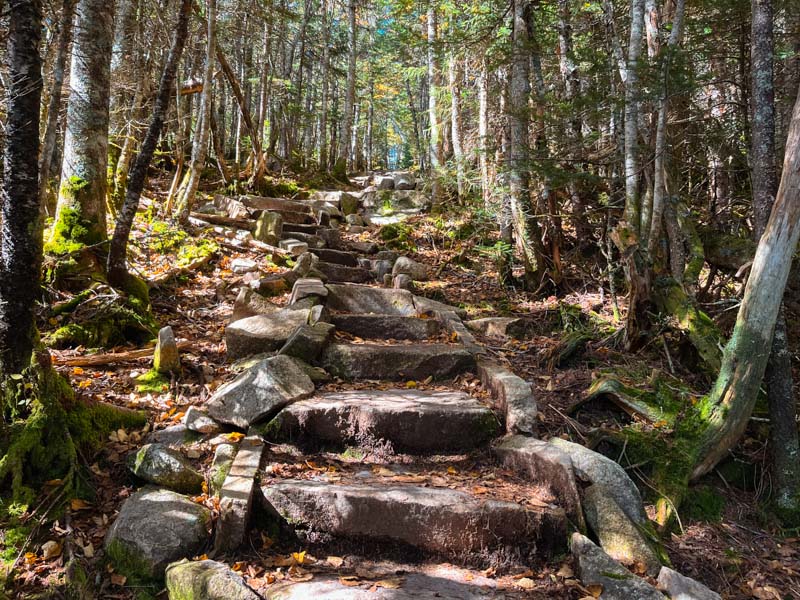
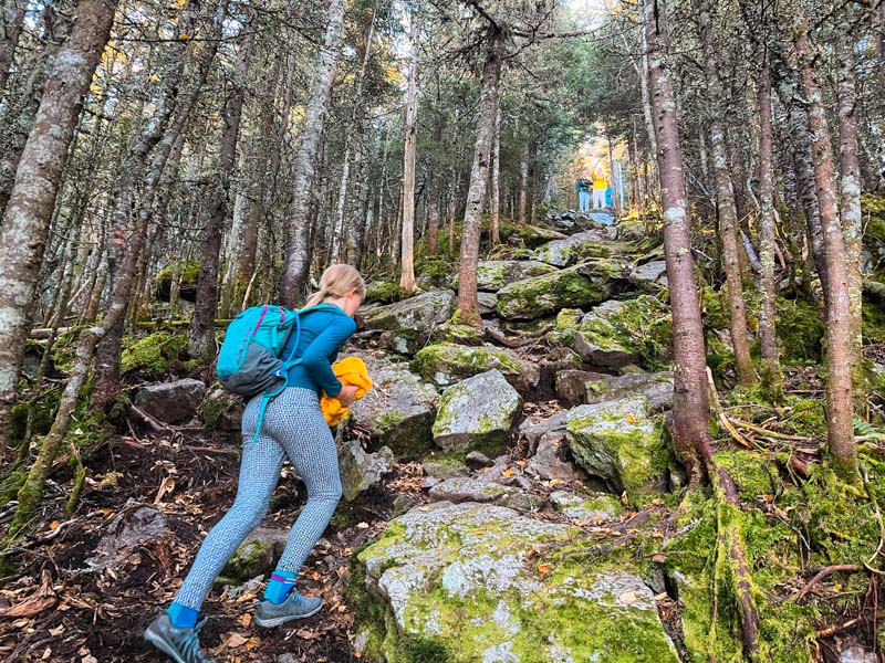
As the trail begins to ascend more steeply, the rocks have been placed into stairs. This is one of the longest areas of stone stair steps I’ve seen in the White Mountains, and the well maintained path makes for easy footing if not a bit of an relentless uphill hike.

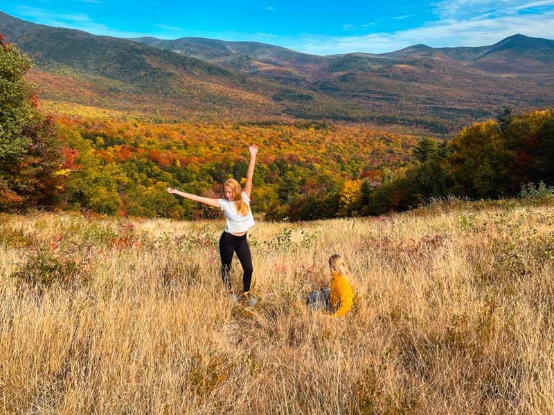
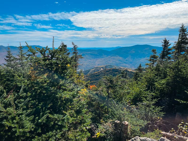
There are 2 small paths that leave and go to the left as you go up the trail that take you out to the ski slope. From here, you have incredible views out across the valley – don’t miss these little side trails!

The trail continues relatively straight and steep from here until it meets up with the Sosman Trail. Stay right and you will see the summit in front of you. The trail splits not far from the summit and there is a small loop at the top. Both ways are similar, but the left up the Sosman Trail is slightly easier. From here you will see the view of the summit open up and a small cairn marking the top.

Summit View
The view from the summit is open for about 180 degrees and gives views far across the valley. Looking north, you will see Osceola, Carrigan and the Presidentials in the distance. The Carters and Wildcats are also visible to the Northeast. Looking east and south you can see Kearsarge North, the Tripyramids, and the Sandwich Range. The best part of the view, especially when the fall colors light up the hills is the sweeping Valley.
Looking for more amazing hikes in the area? Check out: