Volcanos National Park on the big island of Hawaii offers many excellent and varied hiking trails from crater hikes past steam vents to hikes to see hieroglyphics and coastal hikes to see the coastline and sea arch. In this article will share the best hikes in Volcano National Park with information about their length and difficulty to help you choose the best trail or trails for your visit. You can also find some general information to help you plan you time in the park.
We visit the park in 2023 and did most of the hikes in Hawaii Volcanoes National Park and will share first hand information about the park. If you are looking for up to date information about whether parts of the park are open, visit the National Park Service.
You might also find these articles helpful for planning your visit to Hawaii and the National Park:
- Guides to Hawaii
- 2 Day Hawaii Big Island Itinerary
- Guide to Visiting Haleakala National Park
- The Mahaiula and Makalawena Beach Hike: How to Visit these 2 Gorgeous Beaches

Quick Look at the Best Hikes in Volcano National Park
- Crater Rim Trail
- Kilauea Iki Trail
- Thurston Lava Tube
- Halema’uma’u Steam Bluff and Sulfur Banks
- Devastation Trail
- Kīpukapuaulu (Bird Park) Trail
- Pu’u Loa Petroglyph Trailhead
- Kūpinaʻi Pali (Waldron Ledge)
Welcome to Chasing ADVNTR. We are the Carlson family and we love sharing about our adventure travels and providing destination and activity guides to help you plan your own adventures. We have so many travel plans, but are working hard to have 100 Incredible Adventures with Kids Around the World.
Overview of Volcano National Park
There are a few things to know that can help plan your visit to Volcano National Park. First and foremost, it’s essential to stay updated on the park’s current conditions and any volcanic activity alerts issued by the Hawaii Volcano Observatory. Volcano National Park is home to the active Kilauea volcano, and volcanic activity can impact visitor access and safety.
When planning your visit, note that there are several parts of the park.
- The main section (and most popular) is the crater area. Many of the most unique things to see are in this section of the park and it is very close to the entrance and visitor center.
- Chain of Craters Road – this is a drive from the crater down to the coast. We recommend taking this route as it offers a completely different experience. We really loved seeing how the lava has flown over the years.
- Mauna Loa – this part of the park is about an hour drive from the visitor center.
It’s important to come prepared with suitable clothing and gear, as weather conditions within the park can vary, including rain and cooler temperatures at higher elevations. While most of the hiking trail describing in this article are easy, we will recommend hiking boots/shoes. Also plan to bring water and snacks as there is limited facilities throughout the park.
Exploring the park’s diverse landscapes and volcanic features requires careful adherence to designated trails and safety guidelines, as the terrain can be hazardous. Visitors should also be aware of potential sulfur dioxide gas emissions, particularly in areas close to volcanic vents.

Top Tips for Hiking in Volcano National Park
- Most of the best hikes in Volcano National Park are short and easy. This makes it easy to do several hikes in one day. There are also many ways to combine the shorter hikes into much longer hikes. The options make this a great place to explore.
- The park is mostly broken up into 2 parts. The first part include hikes near the volcano crater, the other part is along the road as you drive down to the coast.
- The hikes throughout the area are generally exposed with very little shade. Pack plenty of water and sunscreen.
- Temperatures at Volcano National Park are often cooler, especially at the crater. Bring layers for your hikes.
Best Hikes in Volcanoes National Park
Crater Rim Trail
Distance: 5 miles
Elevation: 400 feet
Difficulty: Easy
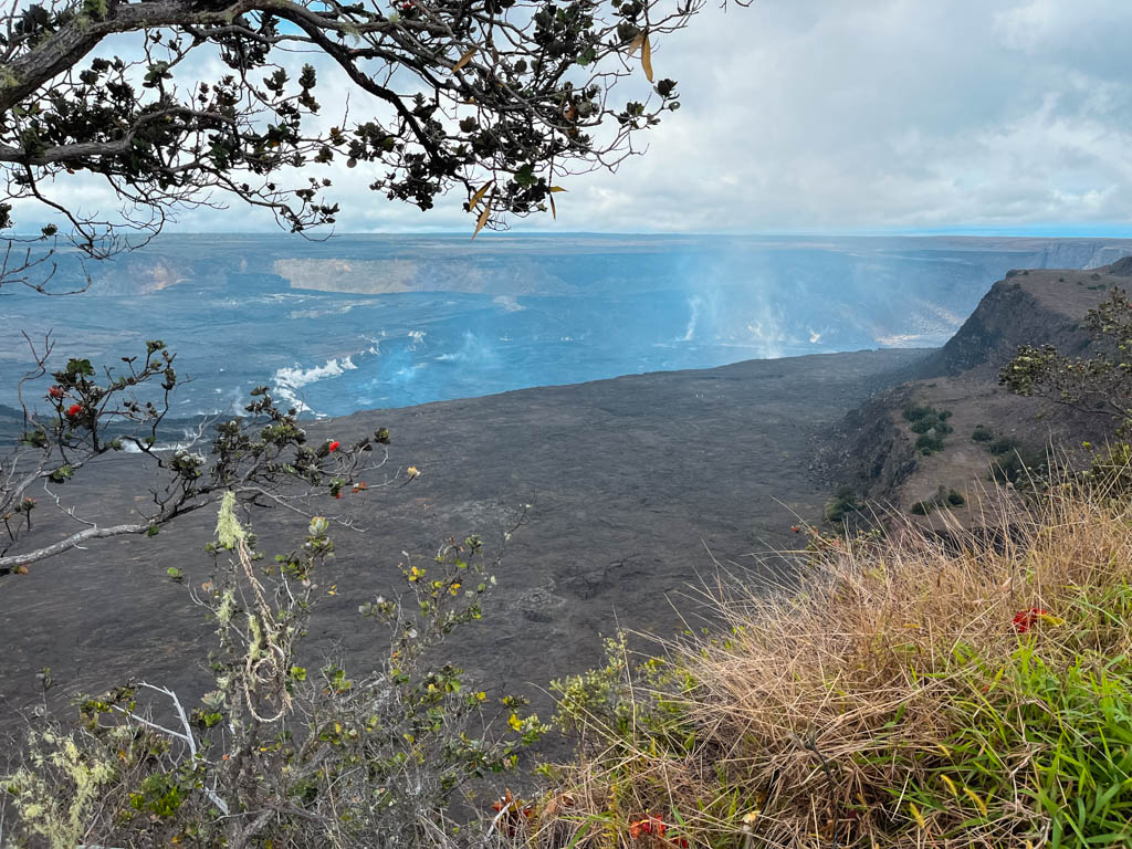
The crater rim is an easy and very popular trail that travel right along the edge of Keanakākoʻi Crater. The trail offers some of the best views in the park with sweeping views out across and into the crater. You will walk past steam vents and may even see lava, depending on the state of the eruption in the park.
The Crater Rim Trail is a must-do hike in the park and is generally easy to walk and travels mostly on open paths. In addition to steam vents, you will also pass through lush forests and can stop at several viewpoints. There are several places to park to access the trail.
Kilauea Iki Trail Loop (including Thurston Lava Tube)
Distance: 3.5 miles
Elevation Gain: 720 feet
Difficulty: moderate/difficult
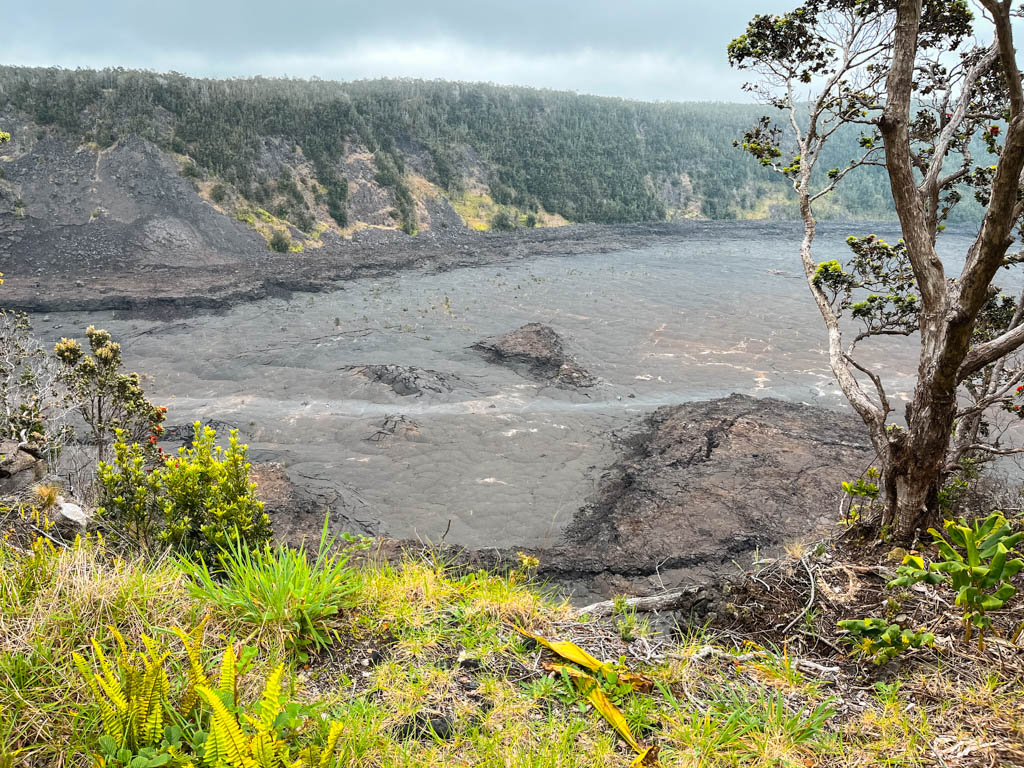
This trail is a loop hike that includes the Crater Rim Trail and a stop at the Thurston Lava Tube. The hike is more challenging than the Crater Rim Trail, but gives you the chance get down into the crater itself. It is also possible to do this hike as an out and back and simply hike down into the crater as long as you like before returning the way you came.
You can park at the Kīlauea Iki Overlook to access this trail.
Thurston Lava Tube
Distance: 0.4 miles
Elevation Gain: minimal
Difficulty: easy
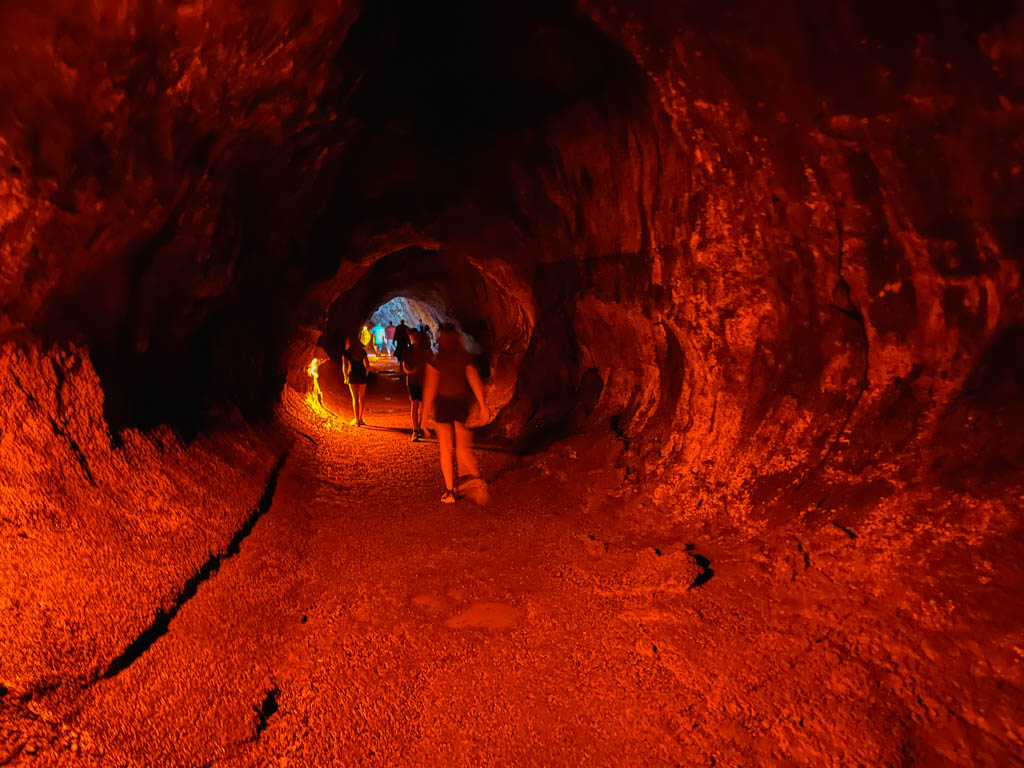
This short little hike can be done as part of a larger hike or on its own. It is a quick and short hike that can be done in 10-15 minutes. The hike is a small loop that takes you through a lush forest and down to the entrance to the lava tube. The lava tube itself is impressive, paved and well lit and you can walk through in just a few minutes.
Lava tubes form when a flowing river of lava forms a hard crust on top. Once the lava finishes flowing, the tube is left in place.
Halema’uma’u Steam Bluff and Sulfur Banks
Distance 1.4 miles
Elevation: minimal
Difficulty: Easy
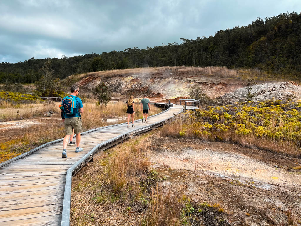
This is a nice loop that leaves right from the visitors center inside the entrance of Volcanos National Park. In our opinion this should be at the top of the list of the best hikes in Volcano National Park (along with the Crater Rim Trail).
The trail wanders through a series of Sulpher vents and you can see steam rising from the ground all around you. the scenery also including interesting vegetation and rocks. This hike can easily be combined with the Crater Rim Trail or you can just enjoy the view of the crater at the start of the Halema’uma’u Steam Bluff Trail.
Devastation Trail
Distance: 1 mile
Elevation: minimal
Difficulty: easy
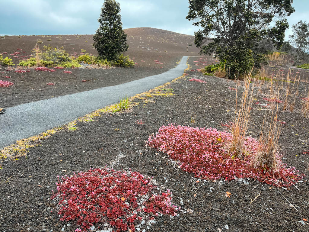
This is a short little trail that takes you on an easy path past a cinder cone/pile to an overlook over the crater. The cinder came from an eruption in 1959 and you can already see how plants are working hard to grow even in this harsh environment.
The trail itself is paved and easy walking and offers an interesting perspective. We enjoyed this trail, but if you are limited on time, you are better off prioritizing the Crater Rim and Sulpher Banks Trail.
Kīpukapuaulu (Bird Park) Trail
Distance: 1.2 miles
Elevation Gain: 175 feet
Difficulty: Easy
The Kīpukapuaulu Trail is a great choice if you love plants animals, specifically birds. You may see birds here that you don’t see anywhere else in the park or the island.
The trail is short and easy and a different experience compared to the volcano and coastal walk as you hike through a forest.
Pu’u Loa Petroglyph Trail
Distance: 1.5 miles
Elevation Gain: 100 feet
Difficulty: moderate
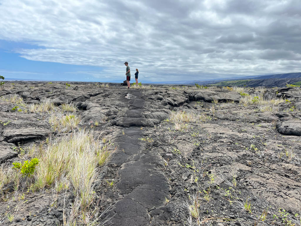
This trail is located down Chain of Craters Road. As you drive down the road, the trailhead is located at the base of the downhill portion of the drive. The trail take about 1 to 1.5 hours and has much rougher footing compared to the other hikes in the park. Make sure to wear good hiking boots/shoes.
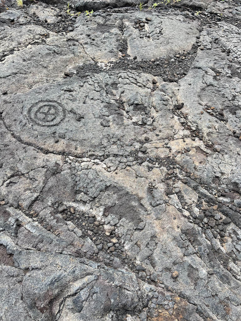
The highlight of this trail is the petroglyphs. At the end of the hike, you will find a series of board walks to view the petroglyphs. Note that there in NO SHADE on this hike and it can be quite hot.
If you still want to see some petroglyphs, but don’t have a lot of time. You can also go for a very short hike directly across the road from the Pu’u Loa Petroglyph Trailhead. Walk for about 8 minutes and you will see some petroglyphs directly on the trail. A ranger told us about this option and we enjoyed seeing the petroglyphs without the crowds.
Kūpinaʻi Pali (Waldron Ledge)
Distance: 1 mile
Elevation Gain: minimal
Difficulty: easy
This is actually a portion of the Crater Rim Trail that is paved and accessible and was once the road along the crater. After an earthquake in 1983, the road was changed over to a walking trail. If you are short on time, you can do just this portion of the Crater Rim trail for excellent views out across the crater.
Summary of the Best Hikes in Volcano National Park
Most of the best hikes in Volcano National Park are easy and relatively short. There are several ways to link together some of the hikes, or you can drive along the crater and the Chain of Craters road and stop for short hikes along the way.
Looking for more information on visiting US National Parks? We are on a mission to see them all! See more to help you plan your National Park adventures on our National Park page.


