
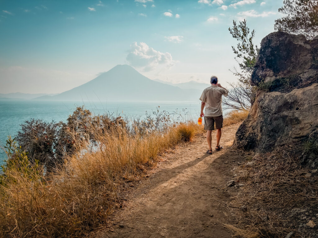
Strung between the towns along Lake Atitlan is a cliffside trail that offers incredible views. The hike from Santa Cruz to Jaibalito Trail follows the cliffs high above the lake with views across to the volcanos. The trail is a great way to connect the towns, or is a wonderful hike if you are staying on one of the two towns. You can also extend this hike all the way to Tzununa.
We hiked the Santa Cruz to Jaibalito Trail from Casa Del Mundo and enjoyed the quiet trail.
Looking for more in Guatemala? Explore all our guides and our itinerary or see other epic hikes around the world.
I’ve spent decades exploring family adventures, epic hikes, and National Parks across the world. For more inspiration, check out my National Parks Page or see some of my favorite destinations to plan your next adventure and make sure to join my weekly newsletter.
Quick Look at the Cliffside Santa Cruz to Jaibalito Trail
Distance: 3 miles
Elevation: 950 feet
Difficulty: moderate
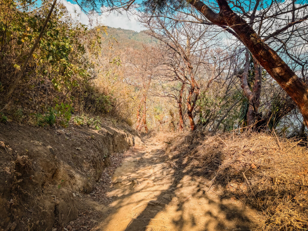
The trail is hiked as either an out and back or can be done as a one way hike with a boat ride as the return trip. Since the trail connects the two towns, you can do this trail in either direction. No matter which way you do this hike, you will have a steep uphill section at the beginning, followed by a relatively flat section along the cliffs and the descent to the next town.
The uphill section has a series of stairs that acends just over 400 feet. This is the hardest part of the hike.
Unlike the other popular trails like Indian Nose on Lake Atitlan, the Santa Cruz to Jaibalito Trail is quiet a route and you might just have the trail to yourself.
You can extend this hike by going from Jaibalito to Tzununa. This makes the hike about twice as long but
History of the Jaibalito and Santa Cruz Trail
The hike between Jaibalito and Santa Cruz La Laguna, often called part of the “Mayan Trail” is deeply rooted in the history and daily life of the region around Lake Atitlán.
For centuries, the Indigenous Kaqchikel Maya communities living around the lake relied on a network of footpaths like this one to travel between villages, long before roads existed. Even today, many lakeside towns, including Jaibalito, remain inaccessible by car and can only be reached by boat or on foot, making these trails essential routes for connection, trade, and daily movement.
Safety on the Cliffside Santa Cruz to Jaibalito Trail
If you’ve looked online at the hikes in this area, you might have seen stories of hikers held at gunpoint. Many of these encounters can be traced to people walking across private land and the owners insisting that they make a payment to pass. We were told by many people that the trail between Santa Cruz and Jaibalito is safe. That said, use caution and make sure to ask people locally and make your own decision. Dave and I did this hike alone and had no issue or concern.
Things to Know About Santa Cruz to Jaibalito Trail
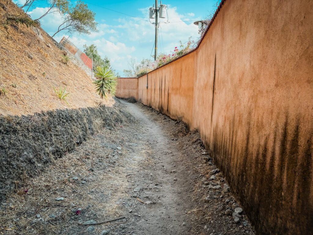
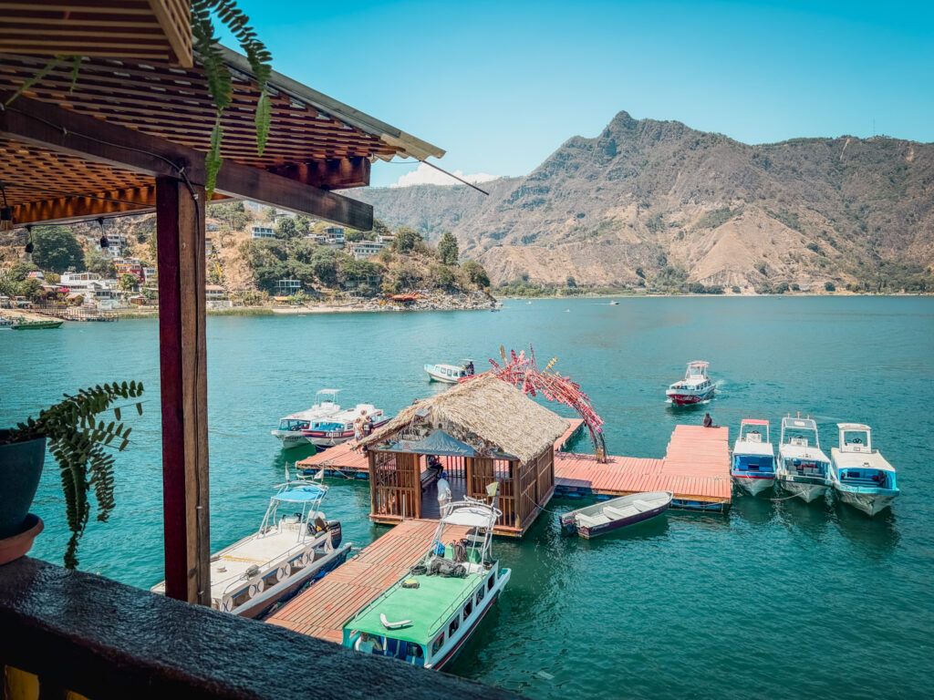
Practical logistics: The trail starts right at both the boat docks in each town. From Santa Cruz, follow the path along the lake. You will reach the end of the hotels and houses and from here will begin to ascend. To get to Santa Cruz, you will take a 15 minute boat ride from Panajachel.
We hiked up to the starting point from Casa Del Mundo and then made our way to Santa Cruz.
Best time to hike: Early morning is probably the best time to hike since you have fewer clouds and the light is the best.
What to bring — Water, sun protection, sturdy shoes, cash for the boat.
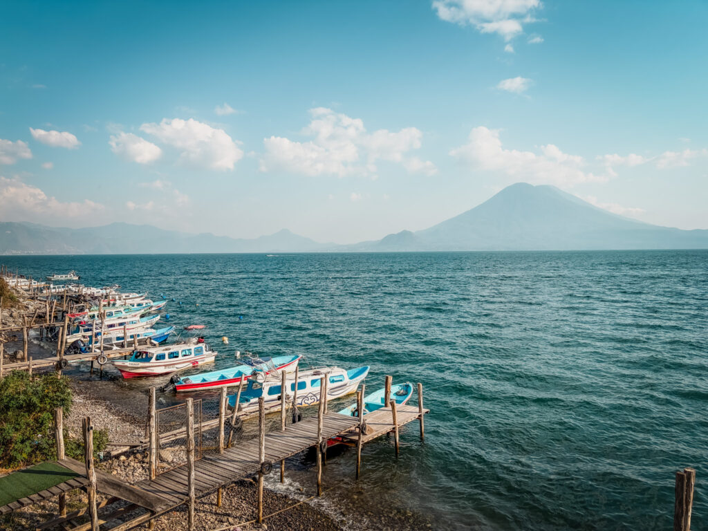
What you’ll see along the way — The trail is wide and traverses the cliff with sweeping views of 3 Volcanoes: Atitlán, Tolimán, and San Pedro
Stop for lunch – a great way to enjoy this trail is to plan a stop for lunch. Casa Del Mundo serve lunch in a beautiful setting or you can find a few places to eat in Jaibalito.
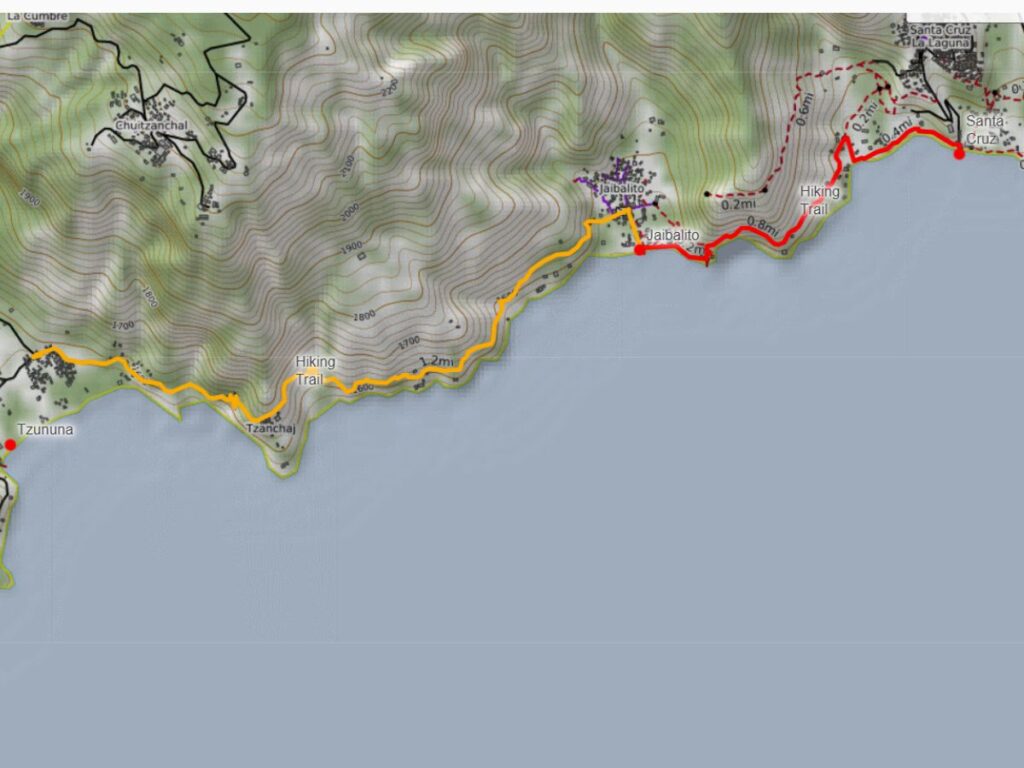
Map of the Santa Cruz to Jaibalito to Tzununa Trail