 Gretchen Stuppy Carlson
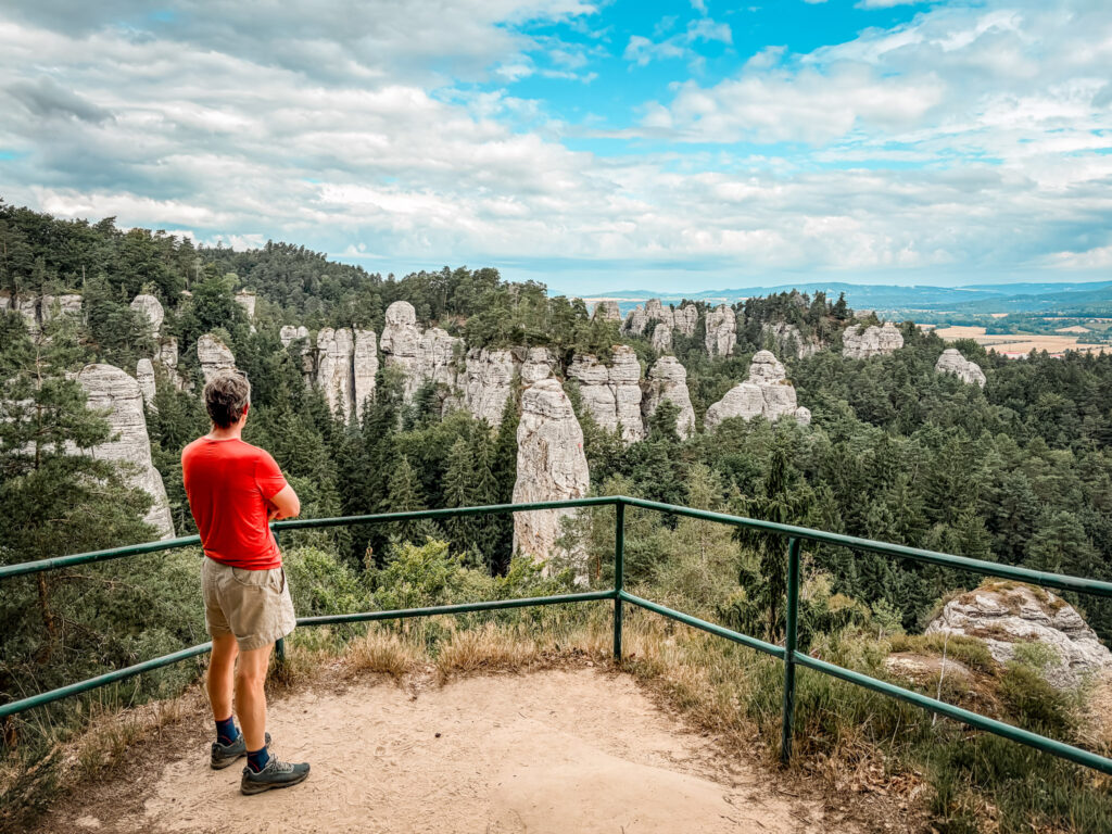
When we first started looking at a short trip to the Czech Republic I knew I wanted to spend some time off the beaten path and outside of Prague. After looking for something a bit different, we landed on exploring the area nearby Hrubá Skála and taking a day trip to Poland. If you are looking for an incredible and unique route, this guide for how to hike Hrubá Skála is the perfect place to start.
Through the hike you will wander through tall rock spires and find lookouts with views out across this impressive valley of rocks.
I've spent decades exploring national parks, hiking trails, and incredible destinations around the world. For more inspiration, explore my National Parks guides and favorite destinations.

Planning a national park trip? Check out National Parks Club for park guides, a growing directory of places to explore, and ready-to-use itineraries. You can also join my weekly Chasing ADVNTR newsletter for more adventure inspiration.
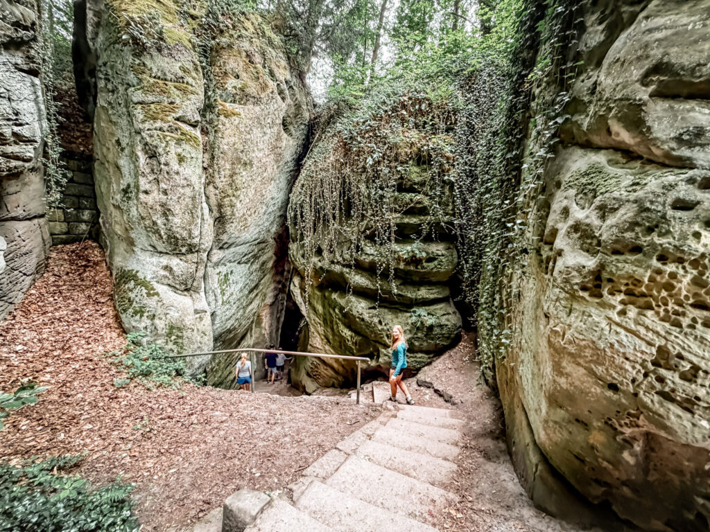
Quick Look at how to Hike Hrubá Skála
Distance: 4.8 miles
Elevation Gain: 840 feet
Difficulty: moderate
Time: Aprroximately 2 hours
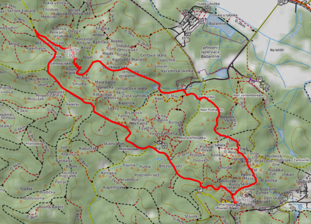
This is a guide to the route that goes through and around the entire area of Hrubá Skála. There are many alternative routes you can take and starting points of this route so it’s easy to shorten or lengthen if you prefer. I recommend selecting trails that take in the view of the rocks from above as well as trails that wander through the rocks and caves below. This is the route we followed.
Use caution as there are drops offs along this trail.
The trail explores the Hruboskalsko rock city, where narrow paths wind between massive sandstone towers and climb to overlooks with views across the surrounding countryside. One of the highlights is Hrubá Skála Castle, perched dramatically above the rocks.
Map of How to hike Hrubá Skála
This is rougly the route we took, but there are many alternative routes as you can see in the trails below.
Things to Know about Hiking Hrubá Skála
Where to Park for the Hrubá Skála Hike
There are several places to start hiking in the Hruboskalsko rock area, but we parked near Hrubá Skála Castle. This is a convenient starting point with access to the main network of hiking trails and you’ll find some food vendors as well.
Parking can be limited during busy periods, especially on summer weekends. Some parking areas charge a fee, so it’s worth having a payment card or some Czech koruna available.
Navigating the Hrubá Skála Trails
One of the most important things to know is that there isn’t just one Hrubá Skála hiking loop. The area has an extensive network of marked trails, and you can easily create a shorter or longer hike. It is slightly confusing at times to decide the correct route so following a map is recommended.
We followed a roughly 4.8-mile loop, but there are plenty of opportunities to adjust your route.
I recommend downloading a map before starting. Although we had some cell service, it wasn’t always reliable. The trails are generally marked, but there are enough intersections that having an offline map makes navigation easier.
Trail Conditions and Difficulty
The Hrubá Skála Castle Loop is a moderate hike with approximately 840 feet of elevation gain. Parts are flat and easy and parts are somewhat steep climbs.
Much of the trail follows forest paths, but there are also rocky sections, stairs, and some steep climbs and descents between the sandstone formations.
The hike isn’t particularly strenuous, but the uneven terrain and frequent elevation changes make sturdy walking shoes or hiking shoes a good choice. Some viewpoints have steep drop-offs, so use extra caution near exposed edges, particularly if you’re hiking with children.
Best Time to Hike Hrubá Skála
Late spring through early fall is generally the best time to explore the Hruboskalsko rock formations. We visited during the summer and found the trails relatively uncrowded, although popular viewpoints and the castle area can get busy especially on weekends (we were there mid-week).
Spring and fall are also excellent times to visit, with cooler hiking temperatures and beautiful forest scenery.
What to Bring
You don’t need specialized hiking equipment for this route, but I recommend bringing:
- Comfortable hiking shoes with good traction
- Water and a few snacks
- A downloaded trail map
- A light rain jacket or extra layer
- A camera for the incredible rock formations and viewpoints
There are some places to purchase food or drinks around the castle area and along popular routes, but don’t count on every stand being open year-round.
Visiting Hrubá Skála Castle
Hrubá Skála Castle is one of the main landmarks in the area and makes a beautiful starting or ending point for your hike.
The castle sits on top of the sandstone formations and is currently used as a hotel. Some areas may be accessible to visitors, but access can vary depending on hotel operations and seasonal opening arrangements. There is a small fee to go in and since we were running late we didn’t go inside the castle.
Even if you don’t go inside, the castle and surrounding viewpoints are worth seeing.
Details of How to hike Hrubá Skála
We did this hike during a 4 day visit to the Czech Republic in the summer of 2026. During our time in the area, we spent 2 nights in Prague and two nights in northeastern Czech Republic. We did this hike during a half day before returning to the city. This is an incredibly cool area to explore and despite the amaze rocks, it was relatively uncrowded. This hike is worth driving out of your way for if you are nearby.
We parked in the main parking lot although there are a few other lots nearby. From here the trail starts through the food stands and descends into the bottom of the rocky canyon immediately through a long thin space between the rocks. This is actually one of the coolest part of the hike. Once you reach the bottom, the trail continues partly flat between the stone towers.
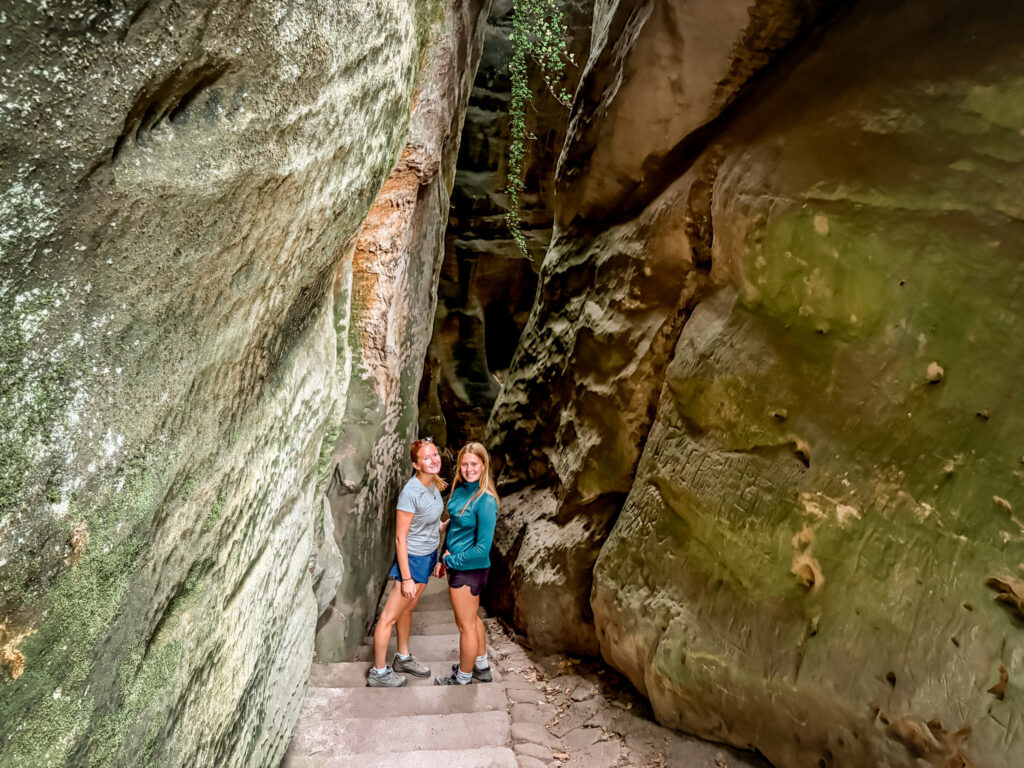
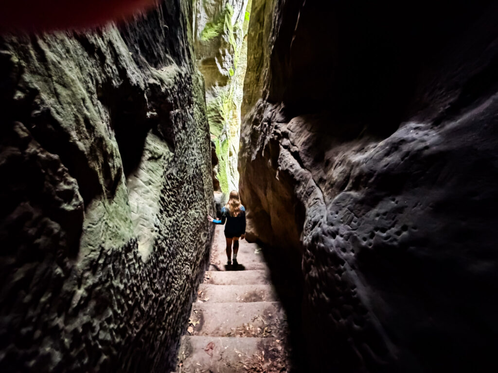
The trail itself continues with short ascents and descends in a large clockwise loop though and around the stone pillars. There are several (actually many) viewpoints that look out across the rocks and at least one place along the way to get some water or an ice cream.
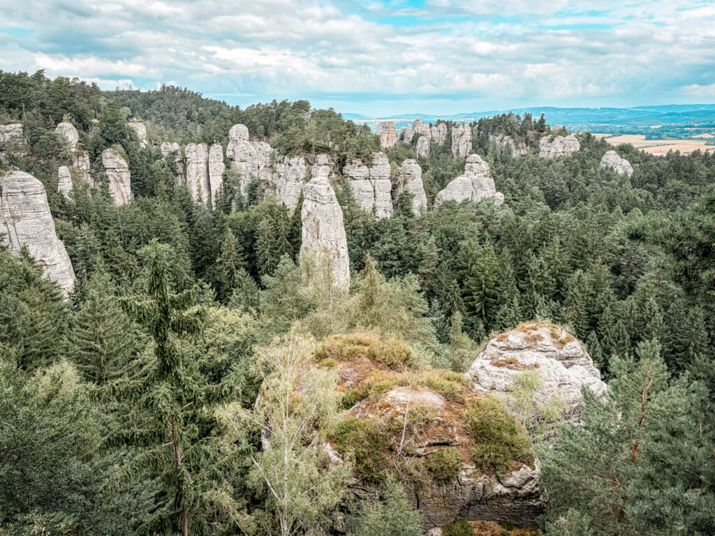
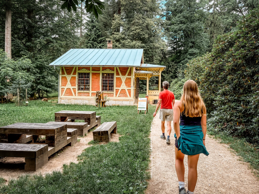
Since we hiked it in a clockwise loop, the trail itself starts high and then most of the second part is down in the bottom of the rocks going in and out of the rock formations. You will likely see climbers in several area.
We had ok cell service, but it’s best to download maps in advance.