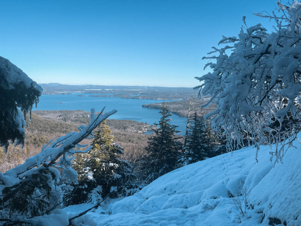
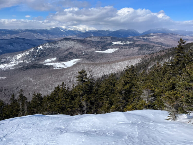
With beautiful views to the distant White Mountains and Lake Winnipesauke, Mount Major is one of the most popular hiking spot in New Hampshire. Located in the Belnap Mountains to the west of the lake, the Mount Major trails give you several options for a day hike. The mountain offers enough of a challenge to make it a fun hike, but it is also one of the best hikes in NH to do with kids.
Below you can find a description of the Mount Major trails, the best way to hike the mountain and everything you need to know about Mount Major to help you plan your trip.
We’ve hiked this mountain in every season and on every trail multiple times so don’t hesitate to leave us a comment below with any questions.
If you are looking for more hiking in New Hampshire, check out:
- 11 Easy Hikes in the White Mountains
- 11 Best Hikes in the White Mountains
- 9 Best Fall Foliage Hikes in New Hampshire
The Following Books are helpful if you plan to hike in the White Mountains and New England.
Quick Look at the Mount Major Trails and Hike
There are several loops your can take to hike Mount Major, below you can see descriptions on a few of the different loops. The first one is the one we recommend, but each trail offers something a bit different. Scroll to the bottom of this post for a detailed description of hiking Mount Major.
Boulder Loop Trail to Brook Trail
Distance: 3.8 miles
Elevation 1,150 feet
Difficulty: Moderate
This is our preferred hiking route on Mount Major. The hike goes up the Boulder Trail (orange) and down the Brook Trail (Yellow). The first part of this trail goes steadily uphill with a few steep boulder climbs towards the end. The trail has views out to the lake through the trees before leveling out at the top for the last 1/4 mile to the summit. The trail descends steadily downhill on the mostly easy Brook Trail and levels out at the bottom when it joins the Main Trail (blue). This is our preferred descent as it is the easiest walking.
Main Trail to Book Trail
Distance: 3.6 miles
Elevation: 1,150 feet
Difficulty: Moderate
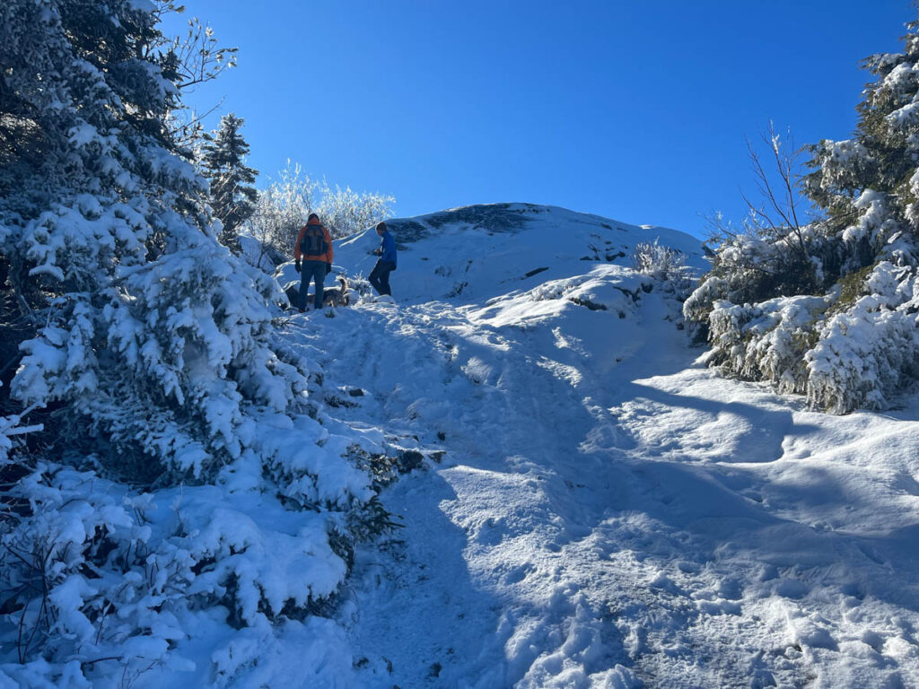
This is a very popular route. The main trail is slightly shorter than the Boulder Trail and has several steep climbs up exposed rock slabs. This is a fun way to hike Mount Major and my kids enjoy the rock slabs – it is also the most crowded. Note that if you hike Mount Major in the winter, this trail can become icy.
Jesus Valley/Beaver Pond Trail to Boulder Trail
Difficulty: 4.6 miles
Elevation 1,259 feet
Difficulty: Moderate
This is a slightly longer trail that passes by several beaver ponds before going uphill. This trail gets a bit muddy and wet depending on the season, but is overall and easy and steady hike up to the summit of Mount Major. The distance described above goes down the Boulder Trail, but you can also descend via the Brook Trail.

Other Trail Options
In addition to the 3 loops described above, there are many ways to increase the milage of this hike. Continue west from the summit and hike the loop of the Staightback Mountains (this makes a loop about 5 miles).
If you are looking for a longer and fun hike, consider doing the entire Belnap Range. This hike is about 10 miles and 3,000 feet of elevation.
Map of Mount Majoring Hiking Trails
Below you can se the map of the Mount Major trails on the map. The top map is posted at the start of the hike and is color coded to the trail blazes.
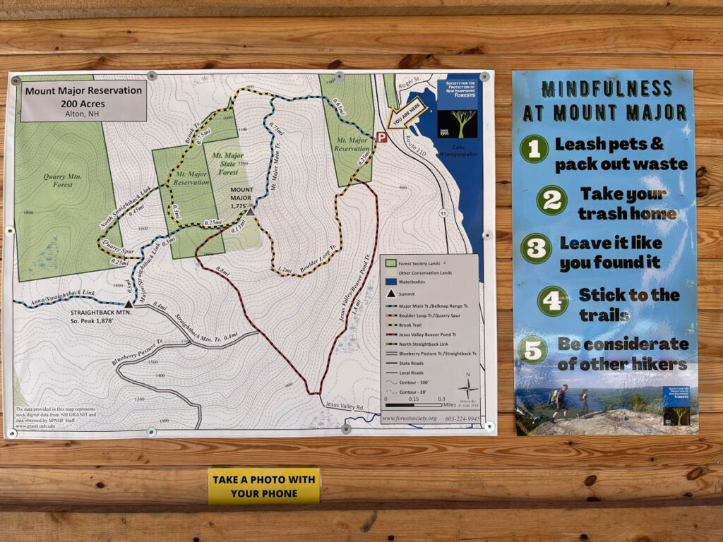
The Mount Major Map below shows the recommended trail in red with some of the other trail options to the west of Mount Major.

Things to Know about Hiking Mount Major
How do you Get to Mount Major?
You will park in the Mount Major parking lot for the hike. Note that you should plan to hike early in the day or late in the day to get a parking spot. Follow signage to avoid a ticket if you end up not getting a spot in the parking lot. The Mount Major Parking lot comes up correctly on every map app we’ve used. The parking lot is to the west of Lake Winnipesauke. Below you can find some common driving distances:
- Portsmouth to Mount Major: 50 min
- Boston to Mount Major: 2 hours
- North Conway to Mount Major: 1 hour and 15 min
- Concord to Mount Major: 45 min

When is the Best Time of Year to Hike Mount Major?
Mount Major can be hiked all year long and winter is actually our preferred time to hike these trails. If you don’t plan to winter hike, the best time of year to hike Mount Major is May-October. In May you will likely have black flies and possible mud. Since this is a popular hike the lot often fills up early in the morning. We like to hike during the winter when the crowds are low and leaves are down providing the best views.
How Hard is Mount Major?
Mount Major is a moderate hike. While it is considered a family friendly hike, it does involve over 1,000 feet of elevation gain. The trail is typical of New Hampshire with rocks, a few steep sections and occasional mud. You should be prepared for a typical day hike.
Are Dogs Allowed on Mt Major?
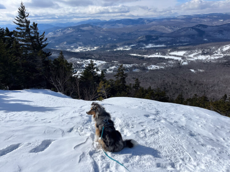
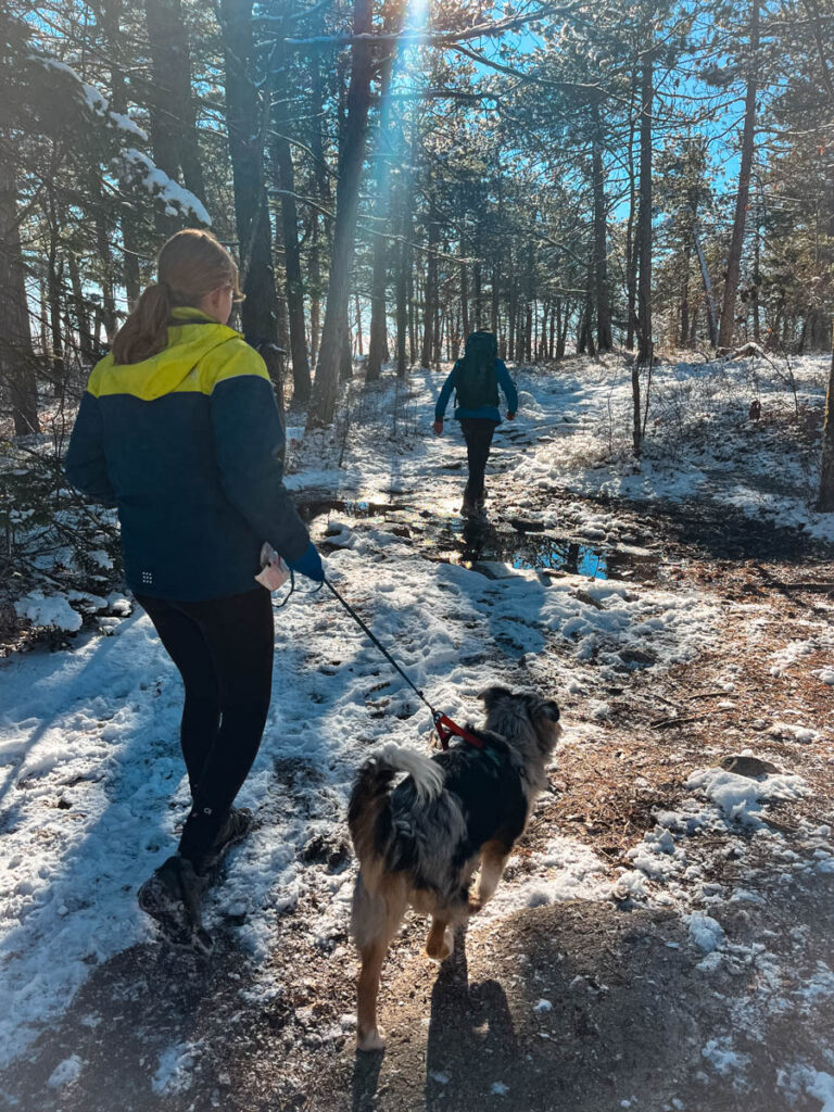
Dogs are allowed on Mount Major but should be kept on leash and you should bring bags to clean up after your pets.
Dogs are allowed on Mount Major
Is there a Fee to Climb Mount Major?
There is no fee to hike Mount Major, but there is a recommended $5 parking fee. This helps cover trail maintenance, and signage. Due to the popularity of this hike there has been a lot of work done over the years to improve the area and protect the environment. Most of the land is owned by the Society for the Protection of NH Forests – please practice Leave No Trace Practices and clean up after yourself and your pets and stay on the trail to avoid increasing erosion.
You can pay the $5 fee right at the trailhead.
What to Bring for your Mount Major Hike
The Mount Major are a popular hike area and while the total mileage is short, it is steep with over 1,000 feet of elevation gain. It is important to wear and bring the appropriate hiking gear and don’t underestimate this hike.
Always dress in layers and bring plenty of food, water, and emergency supplies. Below you can find a few articles that go into what to pack for a day hike. If you are hiking Mount Major in the winter make sure to pack a good pair of microspikes.
15 Day Hike Essentials: Exactly What to Pack for Day Hiking
Best Hiking Gear for Kids: Everything Kids Need For an Epic Hike in 2022
While the trail are well marked, it is helpful to have a good trail map – both paper and a downloaded map for your phone – we took photos of the map at the start of the trail and downloaded a map online even though we’ve hiked this trail multiple times.
For a short video of one of our hikes on Mount Major, click on the video below:

Details of Hiking the Mount Major Trails
We’ve hiked every trail up to and around Mount Major. Our favorite trail is the loop trail up the Boulder Loop Trail (orange blazes) and down the Brook Trail (yellow blazes). Below I will describe each of the hiking routes.
Boulder Loop Trail to the Summit to Brook Trail
This trail is easier to hike up than down, specifically the top section where there are several steep and rocky areas that take some sure footing and careful navigation. This trail tends to be slightly less popular than the main trail. The trail starts by ascending gradually on a wide and well trodden trail. After about 3/4 mile, the trail gets steeper and goes through a few rocky areas.
While Mount Major is not a difficult mountain, this section of the trail is the most challenging (similar to the top of the Main Trail). There are a few steep sections as the trail makes its way up towards the summit. The final 1/4 mile is mostly flat with a final walk to the summit. The summit is wide with several places to sit, excellent views across Lake Winnipesauke and a small rock wall shelter.

After enjoying the summit, you will take the trail that goes off the back of the summit away from the lake. The trail follows the flat top of the summit for a while and then begins to descend. It feels like you are hiking off the back of the mountain, but the trail will begin to gradually turn to the right and descend the mountain. Follow the signs to the right and stay in the Brook Trail. This trail descends steeply for a while but is definitely the easiest of the Mount Major trails to walk down.
The trail eventually flattens out and joins back up with the Main trail and is an easy walk back to the parking lot.
Hiking the Main Trail
The main trail is also a fun trail to hike although we prefer hiking up this trail since it can be tricky to descend. This trail is very popular and you will see many people hiking up this trail. The trail begins with a flat, wide path. After the split with the Brook Trail, the trail slope increases, and you get to the first slabs. These slabs are fun (and challenging) to walk and provide excellent views out across the lake.
The Main Trail can be a challenging section if you are hiking in the winter as the this trail is the most likely to have ice of any of the Mount Major Trails. The trail comes right up the front of the mountain and finally reaches the summit Mount Major. After reaching the summit descend down the preferred Brook Trail or the Boulder Trail.

Jesus Valley/Beaver Pond Trail
This trail is slightly longer than the last two loops described above but offers a fun addition of visiting several beaver ponds. The trail starts on the Boulder Loop Trail and turns to the left. Follow the trail on a flat section for a few minutes. This trail is often muddy even in the summer, so be prepared. After the beaver ponds, the trail bears to the right and begins to ascend steadily towards the summit.
After reaching the summit, you can choose which path to descend. We recommend the Brook Trail, or as a next choice, the Boulder Loop Trail.

Have you hiked the Mount Major trails? Leave us a comment and share your thoughts or let us know your favorite time of year to hike this classic New Hampshire hike!
Looking for more guides to enjoying New Hampshire? Check out:
15 Best Winter Hikes in the White Mountains Region


