One of the most popular 4,000-footers in the White Mountains, Mount Moosilauke offers incredible 360-degree views with a rocky summit and lovely ridge across to South Peak. The best and most popular approach is the Mount Moosilauke Gorge Brook Trail. After summiting, you can return down the way you came, or make this into a loop by hiking down the Snapper Trail and taking in the views at South Peak.
Hiking Mt. Moosilauke as a loop is definitely worth doing and doesn’t change the overall distance or elevation.
Many people hike this trail as one of the 48 – 4,000 footers in NH, but this also makes our list of one of the best hikes in the White Mountains.
Looking to explore adventures around New England? I've spent almost my entire life living in New England and love to explore, photograph, and write about the region. You can find details of incredible hikes, hidden gems, delicious food and my top tips for traveling around the Northeast here and in my newsletter: Uncover New England.

Overview of Hiking Mount Moosilauke Gorge Brook Trail and South Peak Loop
Distance: 8 miles (depending on where you park)
Elevation Gain: 2,700 feet
Difficulty: Challenging
Notes: Summit Elevation of 4,802 feet, this hike takes about 6 hours
With an elevation of 4,802 feet, Mount Moosilauke is one of the taller 4,000+ footers in NH. There are several ways to hike this mountain, but the best and most popular is to hike the Mount Moosilauke and South Peak Loop. Since my favorite part of this hike is the mile between Moosilauke and South Peak, I highly recommend hiking this as a loop instead of just an out-and-back.
You can also hike Moosilauke via the Beaver Brook Trail. This trail is steeper and more challenging.
The Mount Moosilauke Gorge Brook Trail starts at the Dartmouth Moosilauke Ravine Lodge. This is a seasonal road, and you can check to see the conditions here. When the gate is open, there is parking near the lodge and several options further down the road. Depending on where you park, this can add some mileage onto the trail and is one reason you may see a variety of distances listed on this hike.
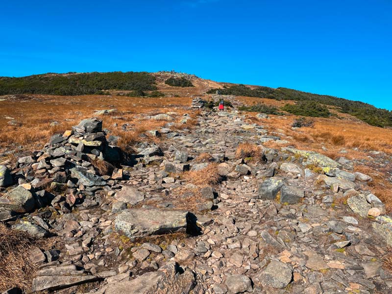
The trail is a typical NH hiking trail with rocky trail conditions. There are several stream crossings – all with either a bridge or an easy way to cross. The trail begins with a steady incline and gets steeper toward the summit. At no point is there any scrambling, or challenging climbing. The final push to the summit is exposed and you can see the top of treeless Moosilauke.

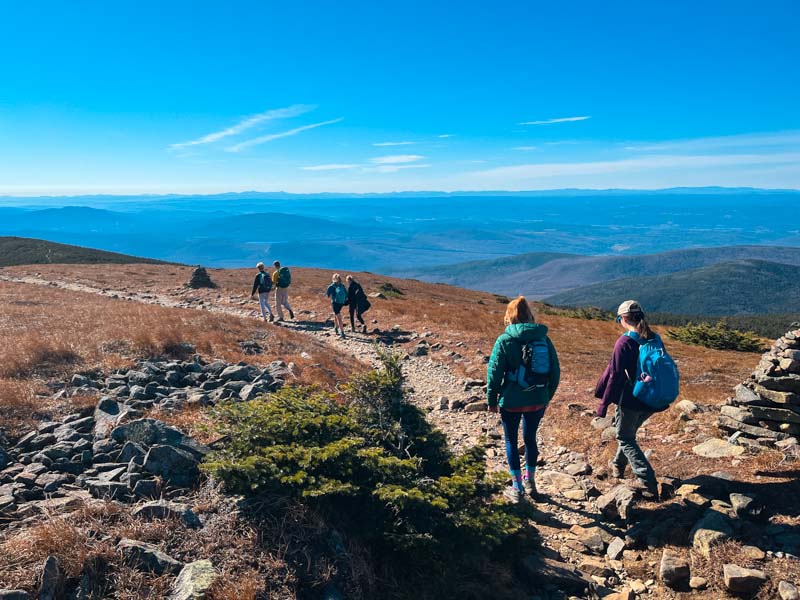
The summit itself is large with plenty of space and several rock walls if you need to get out of the wind. From the summit – there is a short walk out to another viewpoint. To get to South Peak, go over the summit and take the trail to the left. This is a lovely walk that goes across a ridge with great views. After about 1 mile, the well-marked trail to South Peak goes off to the right. This is a short ascent to the top of South Peak (about 0.2 miles) and is completely worth it.
After enjoying the views, continue down the rocky Carriage Road onto the Snapper Trail. This trail descends steadily and is a great place for hiking poles. For the final mile, you will join back up with the Gorge Brook Trail. Read more below for how to get to the Mount Moosilauke Gorge Brook Trail parking area as well as a Mt. Moosilauke hiking map and details of our hike.
Getting to The Gorge Brook Trail for the Mount Moosilauke hike
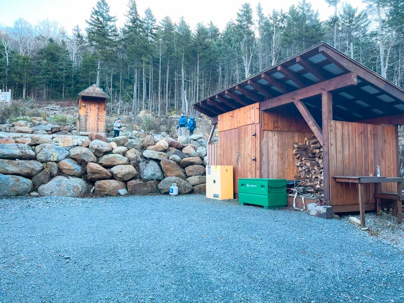
The Mount Moosilauke Gorge Brook Trail is on Ravine Lodge Road in Woodstock, NH. To reach this parking lot enter Moosilauke Ravine Lodge into your map app. You can get to the trailhead by taking route 112 West from route 93. Turn left onto route 118 and continue for 7.2 miles. Ravine Lodge Rd is on your right. There is a gate at the base of the road. If this is closed, you will need to park here, but this adds an extra 1.6 miles each way to your hike.
If the gate is open, drive up the road as far as you can. There is some parking on the left side partway up (we parked here) but this adds more miles to your hike. The best parking is right before the lodge. From here the trail goes downhill on a road until you see the bathrooms and the actual start of the hiking trail.
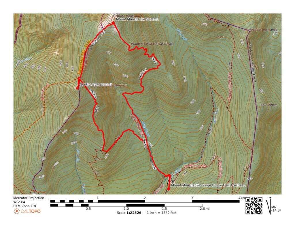
Map of Mount Moosilauke Hike
Below you can see a map of the Mount Moosilauke Gorge Brook Trail and South Peak Loop via the Carriage Rd and Snapper Trail. You can also see a few other trail options. For the latest trail conditions, check the All Trails hike, although we found the trail listing here slightly off.
Details of Hiking Mount Moosilauke
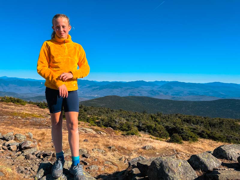
We hiked Mount Moosilauke on a beautiful day at the end of October. It was one of those rare days at the end of the fall when the leaves have fallen, but the air temperature was warm and the wind was calm. We went with a friend who was finishing her last NH 4,000-footer, so we had lots to celebrate.
We started the hike by parking partway down the road up to the Ravine Lodge. This added about 2 miles round trip to our hike, but we didn’t realize there was closer parking. From the parking area, follow the road and turn left following the signs to Moosilauke. The walk to the trail is on a road and you will find a nice pit toilet on your right just before the lodge.
Follow the road and the obvious trail turns off to the left. Follow signs for the Gorge Brook Trail off to the right. This trail leads to the summit and is well-marked. Compared to some of the other higher 4,000-footers, the trail is relatively moderate but rocky. This was my 11-year-old’s 5th 4,000-footer of the fall (she’s already completed Tecumseh, Waumbek, and the Wildcats) and she thought it was the easiest.

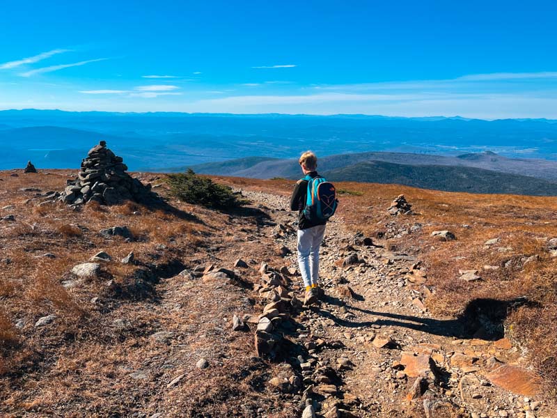
The trail eventually ascends to Moosilauke’s east summit and continues mostly flat with a small descent before the final push to the summit. This entire section has wonderful views and you will be able to see the summit from a distance. Even though we hiked this trail at the end of Oct., the summit was very crowded. Since we were celebrating our friend’s achievement, we hung out at the summit for almost 2 hours and enjoyed the sunshine, views, and some ice cream.
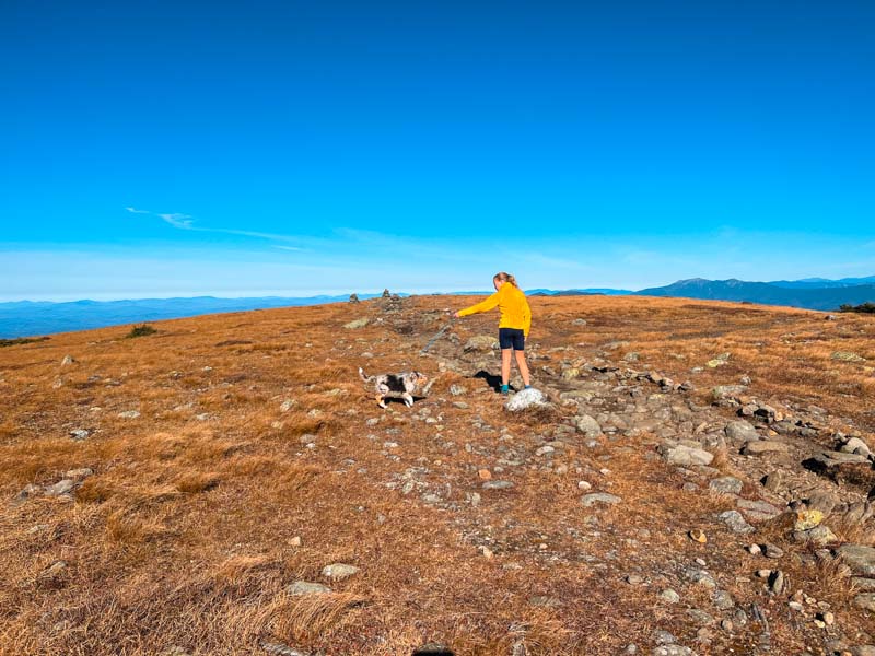
After the summit fun, we headed over to South Peak. This 1-mile walk is awesome through an alpine environment – please stay on the trail and enjoy the view. Make sure to take the side trail to South Peak as it is a short walk and completely worth the views. You get a great view back across to Moosilauke from the summit of South Peak.

The trail back to the parking lot is straightforward. Continue down the Carriage Trail and turn left onto Snapper Trail. This joins back up with the Gorge Brook Trail. We were hiking this trail with our 3-month-old puppy and spent most of the hike carrying her since she’s too young to walk that far. We found this part of the footing on this part of the trail made for slow hiking.
Moosilauke Camp and Lodging Options
There are several places to stay or camp near Moosilauke. You can stay right at the base of the trail at the Ravine Lodge. This lodge is owned by Dartmouth but members of the public can book lodging and meals. Learn more on their website.
If you are looking to camp, look at Lost River Campground or hike into the Beaver Brook shelter (first come first served).
Things to Know about Hiking Mount Moosilauke
Are dogs allowed on Mount Moosilauke?
You bet they are! There were a lot of dogs hiking this trail and mountain and there is no difficult part for dogs. Dogs need to be leashed when hiking Mount Moosilauke.
When is the best time of year to hike Moosilauke?
The best time to hike in the White Mountains is May-Oct. The summit of Moosilauke experiences alpine conditions and can have colder and windier temperatures compared to the valleys. Always pack extra layers for day hikes. This also makes a great winter hike if you are prepared for winter hiking conditions – make sure you have a good pair of microspikes.
How long does it take to climb Mt Moosilauke?
It takes about 5-7 hours to hike Moosilauke via Gorge Brook Trail, Carriage Trail, and Snapper Trail Loop.
How difficult is Mount Moosilauke?
Moosilauke is generally considered a challenging route. While the trail does not offer anything specifically challenging, it is about 8 miles with significant elevation gain. It is generally considered one of the easier NH 4,000-footers.
What is the easiest trail up Mt Moosilauke?
The Gorge Brook Trail is generally considered the easiest trail up Moosilauke from the Ravine Lodge.